
Smithsonian Institution / US Geological Survey
Weekly Volcanic Activity Report, 22 February-28 February 2023
Managing Editor: Sally Sennert
Please cite this report as:
Global Volcanism Program, 2023. Report on Karangetang (Indonesia) (Sennert, S, ed.). Weekly Volcanic Activity Report, 22 February-28 February 2023. Smithsonian Institution and US Geological Survey. https://volcano.si.edu/showreport.cfm?gvpvar=GVP.WVAR20230222-267020
According to PVMBG the eruption at Karangetang’s Main Crater (S crater) continued during 22-28 February. Nighttime webcam images posted with daily reports showed incandescent lava flows descending the flanks, though images from 0054 on 26 February and 0026 on 1 March showed only minor incandescence near the summit. The Darwin VAAC reported that during 22-23 February ash plume rose to an altitude of 2.1 km (7,000 ft) a.s.l. and drifted SE based on analyses of satellite imagery and weather models. The Alert Level remained at 3 (on a scale of 1-4) and the public were advised to stay 2.5 km away from Main Crater with an extension to 3.5 km on the S and SE flanks.
Sources: Pusat Vulkanologi dan Mitigasi Bencana Geologi (PVMBG, also known as CVGHM), Darwin Volcanic Ash Advisory Centre (VAAC)
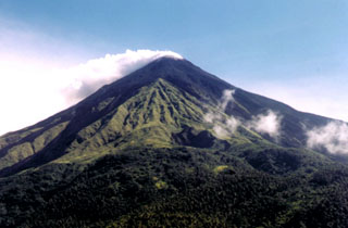
Geological Summary. Karangetang (Api Siau) volcano lies at the northern end of the island of Siau, about 125 km NNE of the NE-most point of Sulawesi. The stratovolcano contains five summit craters along a N-S line. It is one of Indonesia's most active volcanoes, with more than 40 eruptions recorded since 1675 and many additional small eruptions that were not documented (Neumann van Padang, 1951). Twentieth-century eruptions have included frequent explosive activity sometimes accompanied by pyroclastic flows and lahars. Lava dome growth has occurred in the summit craters; collapse of lava flow fronts have produced pyroclastic flows.


 Karangetang