Keyword Collections | Keyword "volcanic gases"
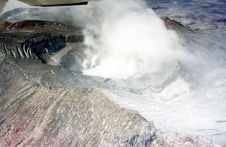 Te Wai ā-Moe (Crater Lake) is seen here within the Ruapehu southern crater with little water remaining during the 1995-96 eruption. Ash and ballistics were deposited onto the glaciers around the summit and much of the crater is exposed. The crater dimensions have changed throughout eruptions, with a 1993 publication noting a lake depth of 134 m. In recent times it typically has a lake volume of 9 million m3 (as of January 2022).
Photo by John A Krippner, 1995-1996.
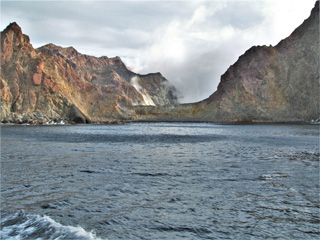 This August 2005 view is looking into the Whakaari/White Island crater through Wilson Bay at the SE of the island. Steam and gases are rising from the crater lake at the far end of the crater, as well as from fumaroles along the crater rim. The units exposed in the inner and outer walls are variably weathered and oxidized lavas, tuffs, and breccias.
Photo by Janine Krippner, 2005.
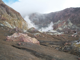 This photo looks towards the western crater lake at Whakaari/White Island, which is emitting volcanic gases and steam. The crater walls expose lavas and tuff deposits, and across the central crater floor (foreground) are blocks and hummocks of the 1912 debris avalanche deposit.
Photo by Janine Krippner, 2005.
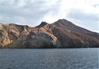 This 22 August 2005 photo shows the E side of the Whakaari/White Island Central Cone showing the exposed stratigraphy of tuff, lava, and breccia units. The gas-and-steam plume rising from the active vent is visible above the flank.
Photo by Janine Krippner, 2005.


