Global Volcanism Program | Image GVP-12807
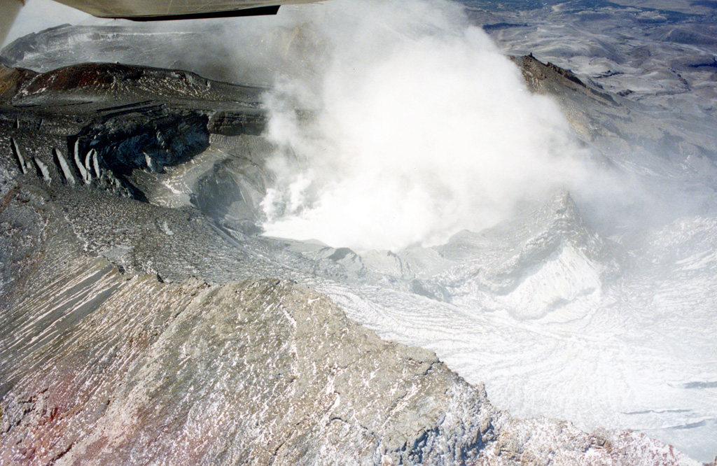
Te Wai ā-Moe (Crater Lake) is seen here within the Ruapehu southern crater with little water remaining during the 1995-96 eruption. Ash and ballistics were deposited onto the glaciers around the summit and much of the crater is exposed. The crater dimensions have changed throughout eruptions, with a 1993 publication noting a lake depth of 134 m. In recent times it typically has a lake volume of 9 million m3 (as of January 2022).
Photo by John A Krippner, 1995-1996.
![]() This image is made available under the Creative Commons BY-ND 4.0 license terms.
This image is made available under the Creative Commons BY-ND 4.0 license terms.
Keywords: crater | vent | eruption | gas emissions | gas | volcanic gases | ashfall | tephra

Ruapehu