Image GVP-01656
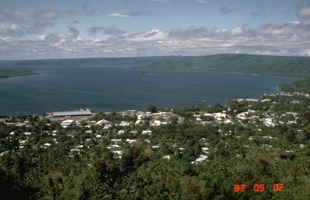
Simpson harbor, seen here from Rabaul Volcano Observatory overlooking the city of Rabaul in 1983, fills the NW part of 8 x 14 km Rabaul caldera. Matupit Island appears at the left margin of the photo, and Vulcan, the site of major eruptions in 1937 and 1994, is the low cone across the harbor at the right-center.
Photo by Norm Banks, 1983 (U.S. Geological Survey).
![]() This image is made available as a Public Domain Work, but proper attribution is appreciated.
This image is made available as a Public Domain Work, but proper attribution is appreciated.
Galleries: Calderas
Keywords: caldera

Rabaul