Image GVP-01997
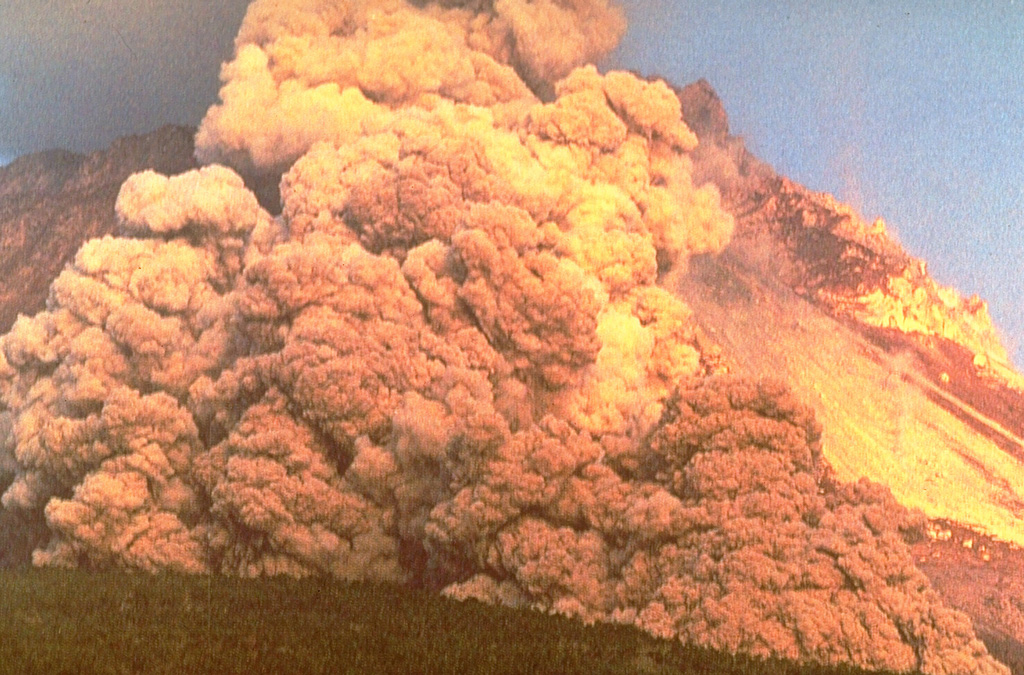
A block-and-ash flow travels down the flank of Fugendake in 1991. These were created by collapse of a lava dome that began on 24 May. The size of the flows gradually increased and on 3 June the largest flow of the eruption to that point swept 3 km down the Mizunashi River valley into Kita-Kamikoba village, killing 43 people and destroying many houses. On 8 June block-and-ash flows traveled 5.5 km to within 50 m of a major highway and destroyed an additional 73 houses.
Photo courtesy Willie Scott, 1991 (U.S. Geological Survey).
![]() This image is made available as a Public Domain Work, but proper attribution is appreciated.
This image is made available as a Public Domain Work, but proper attribution is appreciated.
Galleries: Pyroclastic Flows | Lava Domes | Explosive Eruptions
Keywords: ash plume | eruption | ash | plume | explosive eruption | lava dome | vent | block-and-ash flow | pyroclastic density current (PDC) | human impacts

Unzendake