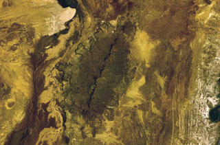
Image GVP-12232
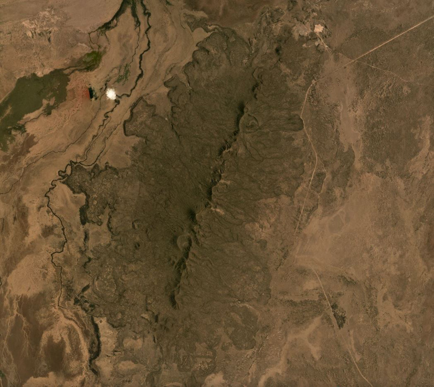
The Korath Range is the northernmost volcano of the Turkana rift in southern Ethiopia/northern Kenya. The central lineament of cones and craters has produced lava flows out to around 6 km from the vents. This September 2019 Planet Labs satellite image monthly mosaic shows the lobate flow margins and lateral flow levees and margins (N is at the top; this image is approximately 20 km across).
Satellite image courtesy of Planet Labs Inc., 2019 (https://www.planet.com/).
Copyrighted image used with permission. All Rights Reserved. Contact photographer for any usage requests.
Keywords: lava flow | crater | rift zone | levee
Korath Range