Image GVP-12468
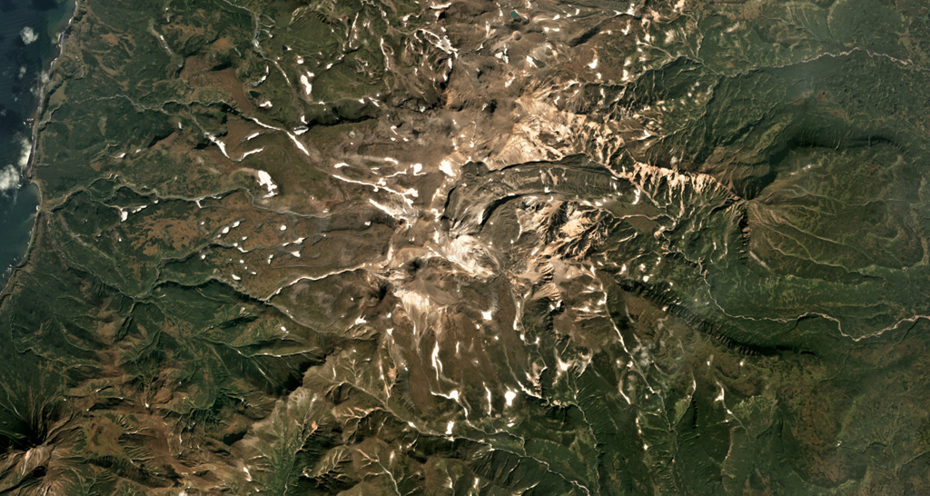
The Vernadskii Ridge in northern Paramushir Island is in the center of this September 2017 Planet Labs satellite image monthly mosaic (N is at the top; this image is approximately 22 km across). The ridge has three main volcano groups including the Vernadskii volcano group in the southern end, and the Bogdanovich volcano group 4-5 km north of that. A 3.5-km-long lava flow with levees and compression ridges was emplaced to the N then turned towards the E.
Satellite image courtesy of Planet Labs Inc., 2017 (https://www.planet.com/).
Copyrighted image used with permission. All Rights Reserved. Contact photographer for any usage requests.
Keywords: stratovolcano | lava flow | levee
Vernadskii Ridge