Image GVP-12505
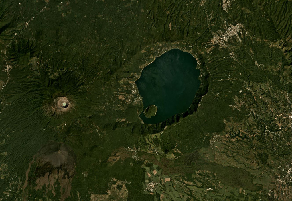
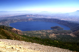
The 7 x 10 km lake-filled Coatepeque Caldera formed 72 ka and is shown in this November 2019 Planet Labs satellite image monthly mosaic (N is at the top; this image is approximately 25 km across). The western caldera rim formed on the Santa Maria eastern flank, and several lava domes formed in the SW area with Cerro Grande forming the island within the lake. Santa Ana with its blue-green crater lake and Izalco with the unvegetated slopes are W and SW, respectively.
Satellite image courtesy of Planet Labs Inc., 2019 (https://www.planet.com/).
Copyrighted image used with permission. All Rights Reserved. Contact photographer for any usage requests.
Galleries: Calderas
Keywords: caldera | lava dome | crater
Coatepeque Caldera