Report on Puyehue-Cordon Caulle (Chile) — 17 August-23 August 2011
Smithsonian Institution / US Geological Survey
Weekly Volcanic Activity Report, 17 August-23 August 2011
Managing Editor: Sally Sennert.
Please cite this report as:
Global Volcanism Program, 2011. Report on Puyehue-Cordon Caulle (Chile) (Sennert, S, ed.). Weekly Volcanic Activity Report, 17 August-23 August 2011. Smithsonian Institution and US Geological Survey.
Puyehue-Cordon Caulle
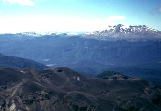
Chile
40.59°S, 72.117°W; summit elev. 2236 m
All times are local (unless otherwise noted)
During 16-23 August, OVDAS-SERNAGEOMIN reported that seismic activity indicated the eruption from the Cordón Caulle rift zone, part of the Puyehue-Cordón Caulle volcanic complex, continued at a low level. Cloudy weather mostly prevented satellite and camera observations of the eruption during 16-17 August, however a mostly white plume was observed by an area camera rising 2 km above the crater on 16 August. A plume that was sometimes gray rose 2.5 km above the crater on 18 August. A plume observed in satellite imagery that same day drifted 200 km NW. A period of harmonic tremor that lasted about 25 minutes may have indicated lava emission. Incandescence was observed at night during 18-19 August.
On 19 August a camera recorded a mostly white plume that rose 2 km above the crater. Satellite imagery showed a plume drifting 270 km NW. During an overflight, conducted by ONEMI in collaboration with the Air Force, scientists observed a white plume rising 1.4 km that was dark gray for the first few meters above the vent. Solidified lava filled up a depression around Cordón Caulle; no active lava flows were noted. On 20 August a plume that was mostly white rose 2.5 km above the crater. Two explosive events caused the plume to rise 4 km and contain a higher concentration of ash. Satellite imagery showed a plume drifting 200 km WNW on 20 August, and 500 km SE and NW on 21 August. A white plume that rose 2 km above the crater was observed on 22 August. Satellite imagery showed a very diffuse plume drifting E. The Alert Level remained at Red.
Geological Summary. The Puyehue-Cordón Caulle volcanic complex (PCCVC) is a large NW-SE-trending late-Pleistocene to Holocene basaltic-to-rhyolitic transverse volcanic chain SE of Lago Ranco. The 1799-m-high Pleistocene Cordillera Nevada caldera lies at the NW end, separated from Puyehue stratovolcano at the SE end by the Cordón Caulle fissure complex. The Pleistocene Mencheca volcano with Holocene flank cones lies NE of Puyehue. The basaltic-to-rhyolitic Puyehue volcano is the most geochemically diverse of the PCCVC. The flat-topped, 2236-m-high volcano was constructed above a 5-km-wide caldera and is capped by a 2.4-km-wide Holocene summit caldera. Lava flows and domes of mostly rhyolitic composition are found on the E flank. Historical eruptions originally attributed to Puyehue, including major eruptions in 1921-22 and 1960, are now known to be from the Cordón Caulle rift zone. The Cordón Caulle geothermal area, occupying a 6 x 13 km wide volcano-tectonic depression, is the largest active geothermal area of the southern Andes volcanic zone.
Source: Servicio Nacional de Geología y Minería (SERNAGEOMIN)