Report on Bardarbunga (Iceland) — 31 December-6 January 2015
Smithsonian Institution / US Geological Survey
Weekly Volcanic Activity Report, 31 December-6 January 2015
Managing Editor: Sally Sennert.
Please cite this report as:
Global Volcanism Program, 2014. Report on Bardarbunga (Iceland) (Sennert, S, ed.). Weekly Volcanic Activity Report, 31 December-6 January 2015. Smithsonian Institution and US Geological Survey.
Bardarbunga
Iceland
64.633°N, 17.516°W; summit elev. 2000 m
All times are local (unless otherwise noted)
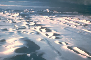
During 31 December-6 January, IMO maintained Aviation Colour Code Orange due to continued activity at Bárdarbunga’s Holuhraun eruptive fissure. The lava was flowing through a closed channel to the E edge of the lava field, about 15 km from the crater. Lava was also flowing N. Seismicity remained strong and local air pollution from gas emissions persisted. Subsidence continued at a rate of 25 cm/day. The lava field covered 83.4 square kilometers on 6 January.
Preliminary analysis of radar measurements taken during an overflight on 30 December showed that the lava is on average 10 m thick in the E part, 12 m thick at the center, and about 14 m in the W part. The maximum thickness, near the craters, was about 40 m at the E margin of the lava lake. A preliminary estimate for the volume of the lava was 1.1 cubic kilometers. Total subsidence of the Bárdarbunga surface since mid-August was 59 m.
Geological Summary. The large central volcano of Bárðarbunga lies beneath the NW part of the Vatnajökull icecap, NW of Grímsvötn volcano, and contains a subglacial 700-m-deep caldera. Related fissure systems include the Veidivötn and Trollagigar fissures, which extend about 100 km SW to near Torfajökull volcano and 50 km NE to near Askja volcano, respectively. Voluminous fissure eruptions, including one at Thjorsarhraun, which produced the largest known Holocene lava flow on Earth with a volume of more than 21 km3, have occurred throughout the Holocene into historical time from the Veidivötn fissure system. The last major eruption of Veidivötn, in 1477, also produced a large tephra deposit. The subglacial Loki-Fögrufjöll volcanic system to the SW is also part of the Bárðarbunga volcanic system and contains two subglacial ridges extending from the largely subglacial Hamarinn central volcano; the Loki ridge trends to the NE and the Fögrufjöll ridge to the SW. Jökulhlaups (glacier-outburst floods) from eruptions at Bárðarbunga potentially affect drainages in all directions.