Report on Nyamulagira (DR Congo) — 16 March-22 March 2022
Smithsonian Institution / US Geological Survey
Weekly Volcanic Activity Report, 16 March-22 March 2022
Managing Editor: Sally Sennert.
Please cite this report as:
Global Volcanism Program, 2022. Report on Nyamulagira (DR Congo) (Sennert, S, ed.). Weekly Volcanic Activity Report, 16 March-22 March 2022. Smithsonian Institution and US Geological Survey.
Nyamulagira
DR Congo
1.408°S, 29.2°E; summit elev. 3058 m
All times are local (unless otherwise noted)
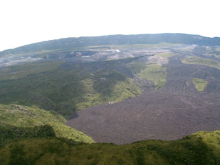
Active lava on Nyamulagira’s crater floor was visible in satellite images during 8-13 March.
Geological Summary. Africa's most active volcano, Nyamulagira (also known as Nyamuragira), is a massive high-potassium basaltic shield about 25 km N of Lake Kivu and 13 km NNW of the steep-sided Nyiragongo volcano. The summit is truncated by a small 2 x 2.3 km caldera that has walls up to about 100 m high. Documented eruptions have occurred within the summit caldera, as well as from the numerous flank fissures and cinder cones. A lava lake in the summit crater, active since at least 1921, drained in 1938, at the time of a major flank eruption. Recent lava flows extend down the flanks more than 30 km from the summit as far as Lake Kivu; extensive lava flows from this volcano have covered 1,500 km2 of the western branch of the East African Rift.
Sources: Observatoire Volcanologique de Goma (OVG), Sentinel Hub

