Report on Sulu Range (Papua New Guinea) — 5 July-11 July 2006
Smithsonian Institution / US Geological Survey
Weekly Volcanic Activity Report, 5 July-11 July 2006
Managing Editor: Sally Sennert.
Please cite this report as:
Global Volcanism Program, 2006. Report on Sulu Range (Papua New Guinea) (Sennert, S, ed.). Weekly Volcanic Activity Report, 5 July-11 July 2006. Smithsonian Institution and US Geological Survey.
Sulu Range
Papua New Guinea
5.5°S, 150.942°E; summit elev. 610 m
All times are local (unless otherwise noted)
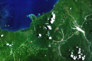
On 10 July, the RVO reported that "forceful, dark emissions" from the Sulu Range were observed on 7 July and decreased to moderate emissions by the morning of 8 July. On 12 July, aerial inspection confirmed that emissions were coming from a NW-S-trending area between Ubia and Ululu volcanoes. The report also indicated that weak to moderate white vapor emissions were observed on 10 through 12 July and seismic activity had increased in intensity and frequency from 6 July. Loud booming and rumbling noises were accompanied by strong tremor picked up at stations at Garbuna and Ulawun volcanoes. On 11 July it was reported that there was no evidence of ash emission and that three villages north of Mount Karai had been evacuated. A large earthquake (intensity of ~7) occurred on 12 July at 0820 that disturbed the shoreline and caused the sea water to become sediment-laden. Local rivers turned muddy due to continuous ground shaking.
Reports of vegetation die-off from late February had not been confirmed due to lack of resources. The Sulu Range has not been active in historical times.
Geological Summary. The Sulu Range consists of a cluster of partially overlapping small stratovolcanoes and lava domes in north-central New Britain off Bangula Bay. The 610-m Mount Malopu at the southern end forms the high point of the basaltic-to-rhyolitic complex. Kaiamu maar forms a peninsula with a small lake extending about 1 km into Bangula Bay at the NW side of the Sulu Range. The Walo hydrothermal area, consisting of solfataras and mud pots, lies on the coastal plain west of the SW base of the Sulu Range. No historical eruptions are known from the Sulu Range, although some of the cones display a relatively undissected morphology. A vigorous new fumarolic vent opened in 2006, preceded by vegetation die-off, seismicity, and dust-producing landslides.
Source: Rabaul Volcano Observatory (RVO)