
Smithsonian Institution / US Geological Survey
Weekly Volcanic Activity Report, 26 September-2 October 2012
Managing Editor: Sally Sennert
Please cite this report as:
Global Volcanism Program, 2012. Report on Batu Tara (Indonesia) (Sennert, S, ed.). Weekly Volcanic Activity Report, 26 September-2 October 2012. Smithsonian Institution and US Geological Survey. https://volcano.si.edu/showreport.cfm?gvpvar=GVP.WVAR20120926-264260
Based on analyses of satellite imagery, the Darwin Volcanic Ash Advisory Centre (VAAC) reported that during 26-28 September ash plumes from Batu Tara rose to an altitude of 2.4 km (8,000 ft) a.s.l. and drifted 18-37 km NW, W, and SW.
Source: Darwin Volcanic Ash Advisory Centre (VAAC)
Geological Summary. The small isolated island of Batu Tara is located in the Flores Sea ~50 km N of Lembata (formerly Lomblen) Island and the main volcanic arc. A scarp on the eastern side reaches the sea, and vegetation covers the other flanks to within 50 m of the summit. This volcano is noted for its potassic leucite-bearing basanitic and tephritic rocks. The first recorded eruption, during 1847-52, produced explosions and a lava flow.


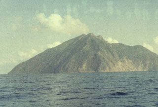 Batu Tara