Report on Paluweh (Indonesia) — 13 February-19 February 2013
Smithsonian Institution / US Geological Survey
Weekly Volcanic Activity Report, 13 February-19 February 2013
Managing Editor: Sally Sennert.
Please cite this report as:
Global Volcanism Program, 2013. Report on Paluweh (Indonesia) (Sennert, S, ed.). Weekly Volcanic Activity Report, 13 February-19 February 2013. Smithsonian Institution and US Geological Survey.
Paluweh
Indonesia
8.32°S, 121.708°E; summit elev. 875 m
All times are local (unless otherwise noted)
CVGHM reported that activity at Paluweh during October 2012-January 2013 was characterized by lava-dome growth, incandescent avalanches, pyroclastic flows, ash plumes that rose as high as 4 km above the dome, and ejected material deposited 3 km away. The whole island was affected by ashfall, which was an average of 2 cm thick on some areas. Some infrastructure and several homes were damaged by ash and lahars.
On 1 February at 1652 an eruption generated an ash plume that rose 2 km. Pyroclastic flows and avalanches were observed. On 2 February an explosion produced an ash plume that rose 4 km and was accompanied by booms and rumbling. The ash plume drifted S and deposited ashfall up to 1 mm thick in Ende (60 km S); thick ashfall was reported in Ona (SE part of the island) and thin deposits were reported in other areas of the island to the W, N, and E. About 25% of the S portion of the dome was lost; the lava-dome volume was an estimated 5.1 million cubic meters on 13 January. On 3 February an ash eruption was observed as well as incandescence from the crater. During 4-10 February diffuse white plumes rose 50-100 m. The Alert Level remained at 3 (on a scale of 1-4), and visitors and residents were prohibited from approaching the crater within a 3-km-radius.
Based on analyses of satellite imagery and wind data, the Darwin VAAC reported that during 17-18 February ash plumes rose to an altitude of 7 km (13,000 ft) a.s.l. and drifted 75 km E and NE.
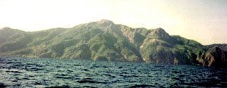
Geological Summary. Paluweh, also known as Rokatenda, forms the 8-km-wide island of Palu'e north of the volcanic arc that cuts across Flores Island. The broad irregular summit region contains overlapping craters up to 900 m wide and several lava domes. Several flank vents occur along a NW-trending fissure. A large eruption in 1928 included strong explosive activity accompanied by landslide-induced tsunamis and lava dome emplacement. Pyroclastic flows in August 2013 resulted in fatalities.
Sources: Pusat Vulkanologi dan Mitigasi Bencana Geologi (PVMBG, also known as CVGHM), Darwin Volcanic Ash Advisory Centre (VAAC)