Report on East Epi (Vanuatu) — 22 February-28 February 2023
Smithsonian Institution / US Geological Survey
Weekly Volcanic Activity Report, 22 February-28 February 2023
Managing Editor: Sally Sennert.
Please cite this report as:
Global Volcanism Program, 2023. Report on East Epi (Vanuatu) (Sennert, S, ed.). Weekly Volcanic Activity Report, 22 February-28 February 2023. Smithsonian Institution and US Geological Survey.
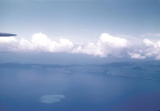
East Epi
Vanuatu
16.6797°S, 168.3893°E; summit elev. 833 m
All times are local (unless otherwise noted)
On 23 February the Vanuatu Meteorology and Geo-Hazards Department (VMGD) reported that minor unrest continued at Epi. Seismicity was sustained though there was only minor manifestation at the water’s surface; steaming at the surface lasting only a few hours at most was occasionally observed. The Alert Level remained at 1 (on a scale of 0-5) and the public was warned to stay outside of the Danger Zone, defined as a 2-km radius around the active vent.
Geological Summary. The submarine East Epi group of basaltic and dacitic cones are located within a possible 10-km-diameter caldera off the NE coast of southern Epi Island in Vanuatu. Three cones (1-1.5 basal diameter), known as Epi A, Epi B (or Cioan), and Epi C, are located along the northern rim of the inferred caldera, though Beier et al. (2018) suggest an alternate to the post-caldera formation model. A few smaller cones are south of Epi B. Ephemeral islands were formed during eruptions at Epi B in 1920 and 1953. Explosive activity was reported in 1958 and 1960, discolored water was often seen during 1971-1974 and 1988, a new vent was detected in 1979, and explosive activity occurred in 1999, 2002, 2004, and 2023. The summit was at 34 m below sea level at the time of a 2001 survey, and a research cruise in 2013 (R/V Sonne SO-229; Haase et al, 2013) sampled six cones, including "very fresh pumice and lava bombs" from Epi B and "relatively old-looking" material from the others. The SO-229 cruise also recovered rhyodacitic pumice with mafic streaks, similar to that sampled by previous cruises, and described Epi B as "covered by massive blocks of pumice."
Source: Vanuatu Meteorology and Geohazards Department (VMGD)