
The Global Volcanism Program has no activity reports available for Amboy.
The Global Volcanism Program has no Weekly Reports available for Amboy.
The Global Volcanism Program has no Bulletin Reports available for Amboy.
|
|
||||||||||||||||||
The Global Volcanism Program is not aware of any Holocene eruptions from Amboy. If this volcano has had large eruptions (VEI >= 4) prior to 12,000 years ago, information might be found on the Amboy page in the LaMEVE (Large Magnitude Explosive Volcanic Eruptions) database, a part of the Volcano Global Risk Identification and Analysis Project (VOGRIPA).
The Global Volcanism Program has no synonyms or subfeatures listed for Amboy.
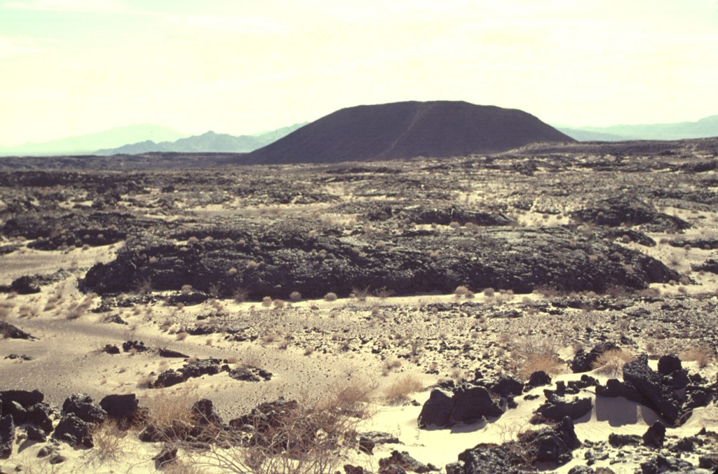
 The 70-sq-km Amboy lava field in southern California is composed mostly of vesicular pahoehoe lava flows that form a hummocky terrain with a surface relief of 2-5 m. Lava tubes are not present in the Amboy flows, which display abundant tumuli and pressure ridges. Light-colored deposits of aeolian sand, thicker to thw SW, fill depressions in the lava flow.
  Amboy Crater is an isolated 75-m-high cinder cone seen here from the NW with the Bullion Mountains in the background. Amboy was the source of a 70-sq-km basaltic lava field that was erupted during the late Pleistocene onto a flat-lying alluvial valley. The dominantly pahoehoe lava field divided the Bristol Dry Lake into two playas. Depressions on the surface of the lava flow are filled with light-colored windblown sand distributed by prevailing winds from the west. The light-colored diagonal stripe on the flank of the cone is a trail leading to the crater rim.
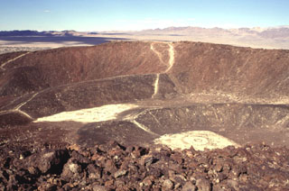
  Amboy Crater is a complex cone formed of at least four nested craters. The rims of two relatively undissected inner cones can be seen in this view from the SE rim of the outer crater of the 75-m-high cinder cone. The two outer cones are breached on their western sides, out of view to the left. Amboy crater is surrounded by a 70-sq-km basaltic lava field. The Bristol Mountains form the skyline.
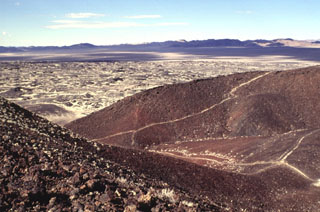
 Amboy Crater is a composite cinder cone that contains at least four nested craters. The two outermost craters are breached to the west. A broad lava field that extends from the cone is visible beyond the breach. Light-colored windblown sand deposited by prevailing winds from the west fill in low spots on the surface of the lava flow.
There are no samples for Amboy in the Smithsonian's NMNH Department of Mineral Sciences Rock and Ore collection.
| Copernicus Browser | The Copernicus Browser replaced the Sentinel Hub Playground browser in 2023, to provide access to Earth observation archives from the Copernicus Data Space Ecosystem, the main distribution platform for data from the EU Copernicus missions. |
|
WOVOdat
Single Volcano View Temporal Evolution of Unrest Side by Side Volcanoes |
WOVOdat is a database of volcanic unrest; instrumentally and visually recorded changes in seismicity, ground deformation, gas emission, and other parameters from their normal baselines. It is sponsored by the World Organization of Volcano Observatories (WOVO) and presently hosted at the Earth Observatory of Singapore.
GVMID Data on Volcano Monitoring Infrastructure The Global Volcano Monitoring Infrastructure Database GVMID, is aimed at documenting and improving capabilities of volcano monitoring from the ground and space. GVMID should provide a snapshot and baseline view of the techniques and instrumentation that are in place at various volcanoes, which can be use by volcano observatories as reference to setup new monitoring system or improving networks at a specific volcano. These data will allow identification of what monitoring gaps exist, which can be then targeted by remote sensing infrastructure and future instrument deployments. |
| IRIS seismic stations/networks | Incorporated Research Institutions for Seismology (IRIS) Data Services map showing the location of seismic stations from all available networks (permanent or temporary) within a radius of 0.18° (about 20 km at mid-latitudes) from the given location of Amboy. Users can customize a variety of filters and options in the left panel. Note that if there are no stations are known the map will default to show the entire world with a "No data matched request" error notice. |
| UNAVCO GPS/GNSS stations | Geodetic Data Services map from UNAVCO showing the location of GPS/GNSS stations from all available networks (permanent or temporary) within a radius of 20 km from the given location of Amboy. Users can customize the data search based on station or network names, location, and time window. Requires Adobe Flash Player. |
| Large Eruptions of Amboy | Information about large Quaternary eruptions (VEI >= 4) is cataloged in the Large Magnitude Explosive Volcanic Eruptions (LaMEVE) database of the Volcano Global Risk Identification and Analysis Project (VOGRIPA). |
| EarthChem | EarthChem develops and maintains databases, software, and services that support the preservation, discovery, access and analysis of geochemical data, and facilitate their integration with the broad array of other available earth science parameters. EarthChem is operated by a joint team of disciplinary scientists, data scientists, data managers and information technology developers who are part of the NSF-funded data facility Integrated Earth Data Applications (IEDA). IEDA is a collaborative effort of EarthChem and the Marine Geoscience Data System (MGDS). |