Global Volcanism Program | Image GVP-06762
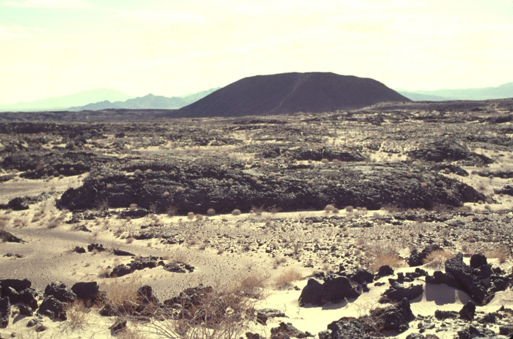
Amboy Crater is an isolated 75-m-high cinder cone seen here from the NW with the Bullion Mountains in the background. Amboy was the source of a 70-sq-km basaltic lava field that was erupted during the late Pleistocene onto a flat-lying alluvial valley. The dominantly pahoehoe lava field divided the Bristol Dry Lake into two playas. Depressions on the surface of the lava flow are filled with light-colored windblown sand distributed by prevailing winds from the west. The light-colored diagonal stripe on the flank of the cone is a trail leading to the crater rim.
Photo by Lee Siebert, 1997 (Smithsonian Institution).
![]() This image is made available under the Public Domain Dedication CC0 license, but proper attribution is appreciated.
This image is made available under the Public Domain Dedication CC0 license, but proper attribution is appreciated.

Amboy