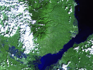
Report on Malindang (Philippines) — August 1991
Bulletin of the Global Volcanism Network, vol. 16, no. 8 (August 1991)
Managing Editor: Lindsay McClelland.
Malindang (Philippines) False report of eruption
Please cite this report as:
Global Volcanism Program, 1991. Report on Malindang (Philippines) (McClelland, L., ed.). Bulletin of the Global Volcanism Network, 16:8. Smithsonian Institution. https://doi.org/10.5479/si.GVP.BGVN199108-271071
Malindang
Philippines
8.22°N, 123.63°E; summit elev. 2404 m
All times are local (unless otherwise noted)
Widely distributed reports of increased activity and up to 20,000 evacuees in mid-September proved false. Heavy cloud cover over the volcano and coincidental tectonic earthquakes prompted claims of an imminent eruption. PHIVOLCS scientists found no signs of activity, although they did locate a previously unknown geothermal area on a remote section of the volcano.
Geological Summary. The Quaternary Malindang volcano is located at the southern end of an eroded massif (Ampiro volcano is at the northern end), W of Iligan Bay in N-central Mindanao. Legends record a large eruption from the dominantly basaltic-to-andesitic volcano in the past, although no confirmed eruptions have been documented (Salise et al., 1991). Reports of increased activity in 1991 at the time of tectonic earthquakes prompted widespread evacuations, and although an eruption did not occur, a previously unknown geothermal area was discovered.
Information Contacts: D. Sussman, Philippine Geothermal, Inc., Manila; Philippine Daily Inquirer and Manila Times, Manila; Reuters.

