Report on Coso Volcanic Field (United States) — February 1992
Bulletin of the Global Volcanism Network, vol. 17, no. 2 (February 1992)
Managing Editor: Lindsay McClelland.
Coso Volcanic Field (United States) Tectonic earthquake swarm
Please cite this report as:
Global Volcanism Program, 1992. Report on Coso Volcanic Field (United States) (McClelland, L., ed.). Bulletin of the Global Volcanism Network, 17:2. Smithsonian Institution. https://doi.org/10.5479/si.GVP.BGVN199202-323180
Coso Volcanic Field
United States
36.03°N, 117.82°W; summit elev. 2400 m
All times are local (unless otherwise noted)
A seismic swarm started on 17 February, with activity peaking by 20 February, and still declining as of 26 February (figure 1). More than 300 small high-frequency earthquakes (eight with M > 3.0) were recorded, the largest (M 4.0) at 0319 on 19 February. Hypocenters show a 3-km-long pattern elongated to the NNW, at 3-5 km depths (figure 2). The focal mechanism for the largest event showed mainly strike-slip motion (right-lateral on a N-S plane, or left-lateral on an E-W plane), with a small normal component. There were no reports of injuries or damages.
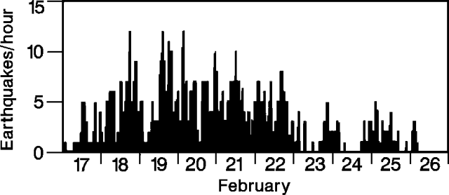 |
Figure 1. Hourly number of earthquakes in the Coso Mountains, 17-26 February 1992. Courtesy of the USGS. |
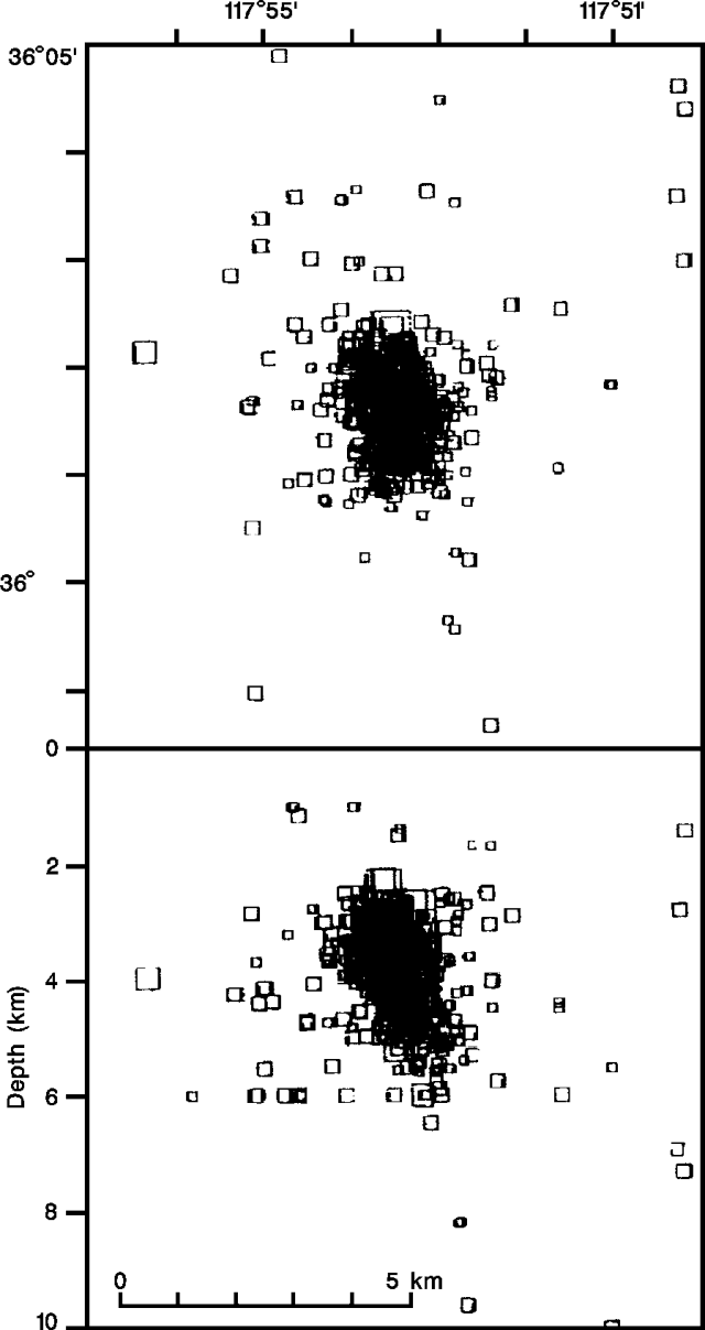 |
Figure 2. Epicenter map (top) and E-W cross-section showing focal depths (bottom) of >300 high-frequency earthquakes recorded in the Coso Mountains, 17-26 February 1992. Courtesy of the USGS. |
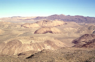
The Coso region is an active geothermal area that has had seismic swarms in the past, as in 1982 when thousands of events were recorded, the largest M 4.9. The Volcano Peak cinder cone and lava flow, apparently the youngest features in the Coso Mountains, are believed to have been erupted 0.039 ± 0.033 mybp. (K/Ar age).
Geological Summary. The Coso volcanic field, located east of the Sierra Nevada Range at the western edge of the Basin and Range province, consists of Pliocene to Quaternary rhyolitic lava domes and basaltic cinder cones covering a 400 km2 area. Much of the field lies within the China Lake Naval Weapons Center. Active fumaroles and thermal springs are present in an area that is a producing geothermal field. The youngest eruptions were chemically bimodal, forming basaltic lava flows along with 38 rhyolitic lava flows and domes, most with youthful, constructional forms. The latest dated eruption formed the Volcano Peak basaltic cinder cone and lava flow and was K-Ar dated at 39,000 +/- 33,000 years ago. Although most activity ended during the late Pleistocene, the youngest lava dome may be of Holocene age based on geomorphological evidence (Monastero 1998, pers. comm.).
Information Contacts: J. Mori and W. Duffield, USGS.