Report on Spurr (United States) — May 1992
Bulletin of the Global Volcanism Network, vol. 17, no. 5 (May 1992)
Managing Editor: Lindsay McClelland.
Spurr (United States) Ash eruption follows increased seismicity and thermal activity
Please cite this report as:
Global Volcanism Program, 1992. Report on Spurr (United States) (McClelland, L., ed.). Bulletin of the Global Volcanism Network, 17:5. Smithsonian Institution. https://doi.org/10.5479/si.GVP.BGVN199205-313040
Spurr
United States
61.299°N, 152.251°W; summit elev. 3374 m
All times are local (unless otherwise noted)
Seismicity continued at abnormally high levels through early June. Much of the elevated seismicity since August 1991 has been concentrated beneath the main summit, and more recently beneath Crater Peak, 3 km S. The events occurred at 0-5 km depth. Most had magnitudes <1.0; maximum magnitude was 1.7. No long-period events have been recorded.
A localized increase in seismicity was recorded at about 0700 on 6 June, centered immediately beneath Crater Peak. The seismicity, different from previously recorded events, was characterized by bursts of 1-5-minute duration. These bursts of tremor-like activity were small, comparable to events that are often associated with hydrothermal activity at other volcanoes. Similar seismicity continued beneath Crater Peak in the succeeding weeks.
Geologists overflew Crater Peak on 8 June. Its small turquoise-colored crater lake (previously measured at 55°C), appeared darker than before and thermal upwelling was visible at the E end of the lake. Only a trace of SO2 was measured in the plume, similar to October 1991. During a visit on 11 June, the crater lake was dark gray, with a temperature of 50°C and a pH of 2.5. The large upwelling was still visible, as were a dozen smaller features, mostly near the E side of the lake. An increase in fumarolic activity was noted in the crater. One prominent fumarole in the talus cone N of the lake was gushing water, and periodically produced several 1-m-high geysers.
On 27 June, a series of explosive pulses produced a substantial ash plume. The eruption was preceded by increased seismicity, including a pair of tremor bursts lasting 2 1/2 hours each on 24 and 25 June, twice as long as any other episodes since they were first recorded on 6 June. An overflight on 26 June at about 1100 showed that the level of Crater Peak's lake had dropped, perhaps indicating increased heating. Continuous tremor began at 1204, and a swarm of volcano-tectonic earthquakes started at 0300 the next morning.
A moderate explosive eruption that began at 0704 on 27 June sent ash to about 8 km altitude. Additional seismic signals that may have indicated eruptive pulses were received at 0814 and 0904. Weather clouds obscured the volcano, limiting direct ground-based or satellite observations of the eruption, but the plume could be tracked as it spread N, away from populated areas. About 0.3 cm of sand-sized ash fell at Finger Lake, roughly 100 km N of the volcano. By late morning, satellite images showed that the plume extended 335 km at an azimuth of 005°, and had a maximum width of 75 km, about 200 km from the volcano. Pilot reports indicated that the top of the cloud was at about 9 km altitude. By midafternoon, the plume, heading 010°, was 670 km long and reached 200 km width 450 km from Spurr. Its base was reported at about 1500 m altitude from an aircraft roughly 400 km NNE of Spurr. After initially moving N, the plume turned toward the S and E, and had spread over western and central Canada by 29 June, when its narrow leading edge was over southern Lake Winnipeg, roughly 3500 km SE of the volcano. No new eruptions had been reported at press time, but a pilot saw a white cloud rising vertically from the volcano to 6-7.5 km altitude on 28 June at 0340. During an overflight early 29 June, the volcano was steaming, and debris and some incandescent material were present in and around the crater, but no major morphologic changes were evident. Mudflows and flooding associated with the eruption were apparently relatively minor.
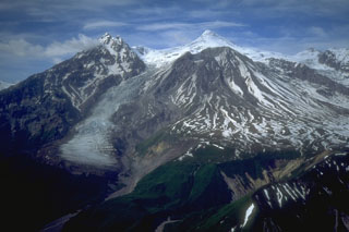
Geological Summary. Mount Spurr is the closest volcano to Anchorage, Alaska (130 km W) and just NE of Chakachamna Lake. The summit is a large lava dome at the center of a roughly 5-km-wide amphitheater open to the south formed by a late-Pleistocene or early Holocene debris avalanche and associated pyroclastic flows that destroyed an older edifice. The debris avalanche traveled more than 25 km SE, and the resulting deposit contains blocks as large as 100 m in diameter. Several ice-carved post-collapse cones or lava domes are present. The youngest vent, Crater Peak, formed at the southern end of the amphitheater and has been the source of about 40 identified Holocene tephra layers. Eruptions from Crater Peak in 1953 and 1992 deposited ash in Anchorage.
Information Contacts: AVO; SAB, NOAA/NESDIS; AP.

