Report on Kuchinoerabujima (Japan) — August 1999
Bulletin of the Global Volcanism Network, vol. 24, no. 8 (August 1999)
Managing Editor: Richard Wunderman.
Kuchinoerabujima (Japan) Increased seismicity, but no change at the fumaroles
Please cite this report as:
Global Volcanism Program, 1999. Report on Kuchinoerabujima (Japan) (Wunderman, R., ed.). Bulletin of the Global Volcanism Network, 24:8. Smithsonian Institution. https://doi.org/10.5479/si.GVP.BGVN199908-282050
Kuchinoerabujima
Japan
30.443°N, 130.217°E; summit elev. 657 m
All times are local (unless otherwise noted)
The Japan Meteorological Agency (JMA) reported an increase in seismic activity on Kuchinoerabu-jima since July 1999 based on data from Sakura-jima Volcano Observatory (SVO), Kyoto University. The number of earthquakes/month increased, rising from 26 in June, to 87 in July, and to 195 in August. By mid-September, JMA and SVO had not observed any anomalous change in fumaroles in the craters of Shin-dake (the youngest volcanic cone).
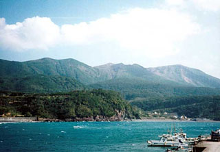
Kuchinoerabu-jima is a volcanic island 12 km long and 5 km wide located ~100 km SSW of southern Kyushu Island and Sakura-jima volcano. An andesite stratovolcano, Kuchinoerabu-jima includes both an older edifice to the NW and young edifices (Furudake and Shindake cones) to the SE. Historical eruptions at Shindake were phreatic. An eruption in December 1933 killed 8 persons and injured 26.
Geological Summary. A group of young stratovolcanoes forms the eastern end of the irregularly shaped island of Kuchinoerabujima in the northern Ryukyu Islands, 15 km W of Yakushima. The Furudake, Shindake, and Noikeyama cones were erupted from south to north, respectively, forming a composite cone with multiple craters. All historical eruptions have occurred from Shindake, although a lava flow from the S flank of Furudake that reached the coast has a very fresh morphology. Frequent explosive eruptions have taken place from Shindake since 1840; the largest of these was in December 1933. Several villages on the 4 x 12 km island are located within a few kilometers of the active crater and have suffered damage from eruptions.
Information Contacts: Volcanological Division, Seismological and Volcanological Department, Japan Meteorological Agency (JMA), 1-3-4 Ote-machi, Chiyoda-ku, Tokyo 100 Japan; Setsuya Nakada, Volcano Research Center, ERI, University of Tokyo, Yayoi 1-1-1, Bunkyo-ku, Tokyo 113, Japan (URL: http://www.eri.u-tokyo.ac.jp/VRC/index_E.html).

