Report on Inielika (Indonesia) — December 2000
Bulletin of the Global Volcanism Network, vol. 25, no. 12 (December 2000)
Managing Editor: Richard Wunderman.
Inielika (Indonesia) Explosions eject tephra in first eruption since 1905
Please cite this report as:
Global Volcanism Program, 2000. Report on Inielika (Indonesia) (Wunderman, R., ed.). Bulletin of the Global Volcanism Network, 25:12. Smithsonian Institution. https://doi.org/10.5479/si.GVP.BGVN200012-264090
Inielika
Indonesia
8.73°S, 120.98°E; summit elev. 1559 m
All times are local (unless otherwise noted)
A minor explosion occurred at 1915 on 11 January 2001. The explosion ejected ash that coated Bajawa (~8 km from the summit) with an ash layer less than 0.5 mm thick. Increased activity after 11 January prompted the VSI to set the volcano's hazard status to 3 (on a scale of 1-4). Three explosions occurred at about 0700 on 13 January, sending ash 300-1,000 m above the crater rim. Workers at the volcano's observatory post, located ~7.5 km from the summit, subsequently heard thundering sounds. Ash, which appeared dense and light in color, blew E to Toa and S to Boya, Bolodio, and Bajawa. By 15 January, a seismograph recorded continuous tremor with an amplitude of 2 mm in addition to 59 explosion earthquakes with amplitudes of 2-14 mm.
Ash emission was ongoing as of 16 January, and ranged from 100 to 1,000 m above the summit. VSI workers observed two new large craters trending SE-NW. The top of the SE crater measured 50 m in diameter, narrowed to 25 m at its base, and was 10 m deep. It emitted an audible sound and ejected an ash plume from its N wall with variable pressure. Winds tended to blow ash toward the S. The NW crater was 20 m in diameter and 1.1 m deep. The temperature of a fumarole measured 95°C, and nearby ground temperature measured 89°C.
During 16-22 January, explosions produced both ash and lapilli. Light gray ash fell around the main crater within a 10-20 m radius. Lapilli, which had a maximum size of 50 cm, fell up to 500 m from the main crater.
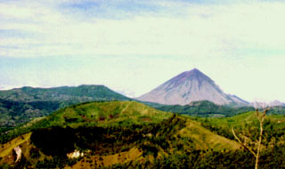
Geological Summary. Inielika is a broad, low volcano in central Flores Island that was constructed within the Lobobutu caldera. The complex summit contains ten craters, some of which are lake filled, in a 5 km2 area north of the city of Bajawa. The largest of these, Wolo Runu and Wolo Lega North, are 750 m wide. A phreatic explosion in 1905 formed a new crater, and was the volcano's only eruption during the 20th century. Another eruption took place about a century later, in 2001. A chain of Pleistocene cinder cones, the Bajawa cinder cone complex, extends southward to Inierie.
Information Contacts: Dali Ahmad, Volcanological Survey of Indonesia (VSI), Jalan Diponegoro No. 57, Bandung 40122, Indonesia (URL: http://www.vsi.esdm.go.id/).