Report on Karangetang (Indonesia) — May 2002
Bulletin of the Global Volcanism Network, vol. 27, no. 5 (May 2002)
Managing Editor: Richard Wunderman.
Karangetang (Indonesia) Small explosions and increased seismicity during April 2002
Please cite this report as:
Global Volcanism Program, 2002. Report on Karangetang (Indonesia) (Wunderman, R., ed.). Bulletin of the Global Volcanism Network, 27:5. Smithsonian Institution. https://doi.org/10.5479/si.GVP.BGVN200205-267020
Karangetang
Indonesia
2.781°N, 125.407°E; summit elev. 1797 m
All times are local (unless otherwise noted)
During 25 February through at least 16 June 2002, seismicity at Karangetang was dominated by shallow volcanic (B-type) and tectonic earthquakes (table 4). Thick, white, medium-pressure plumes were typically emitted from the main crater (S) and reached 50-500 m above the crater rim. During late May through at least 16 June, a thin-medium white plume was emitted from crater II (N) and reached 150-200 m above the crater rim. During most of the report period a red reflection was observed around the summit at night, rising 10-75 m.
Table 4. Earthquakes recorded at Karangetang during 25 February through 16 June 2002. The Alert Level remained at 2 throughout this period. Courtesy VSI.
| Date | Deep volcanic (A-type) | Shallow volcanic (B-type) | Multiphase | Tectonic |
| 25 Feb-02 Mar 2002 | 52 | 5 | 6 | 62 |
| 03 Mar-10 Mar 2002 | 44 | 20 | 2 | 201 |
| 11 Mar-17 Mar 2002 | 29 | 8 | 9 | 100 |
| 18 Mar-24 Mar 2002 | 15 | 8 | 6 | 83 |
| 25 Mar-31 Mar 2002 | 20 | 9 | 2 | 112 |
| 01 Apr-07 Apr 2002 | 27 | 3 | 2 | 71 |
| 08 Apr-14 Apr 2002 | 17 | 64 | -- | 82 |
| 15 Apr-21 Apr 2002 | 26 | 74 | -- | 147 |
| 22 Apr-28 Apr 2002 | 17 | 61 | 2 | 146 |
| 29 Apr-05 May 2002 | 28 | 99 | 6 | 139 |
| 06 May-12 May 2002 | 22 | 70 | 0 | 132 |
| 13 May-19 May 2002 | 8 | 77 | 1 | 112 |
| 20 May-26 May 2002 | 22 | 93 | 6 | 146 |
| 27 May-02 Jun 2002 | 18 | 1228 | 4 | 113 |
| 03 Jun-09 Jun 2002 | 13 | 119 | 3 | 75 |
| 10 Jun-16 Jun 2002 | 12 | 62 | 1 | 45 |
Several eruptions occurred during the report period. An eruption on 5 March at 1344 emitted ash that reached 1.5 km above the summit. Ash fell on the NE flank and a lava avalanche also occurred. During the week of 3-10 March, 1 earthquake was felt. On 23 March 2002 at 1115 a thundering sound was heard from main crater, followed by a lava avalanche that flowed down to Kahetang and Batu Awang rivers. A thundering sound was heard beginning at 1615 on 28 March until 2007 on 29 March. No lava avalanches occurred during this time, but 3 earthquakes were felt during the last week of March. A medium explosion on 7 April at 2115 emitted thick gray ash to ~400 m above the crater rim.
The number of deep and shallow volcanic earthquakes increased during April (table 4). An ash explosion on 12 May at 1116 emitted ash that reached 750 m above the crater before falling to the sea on the E side. The explosion was followed by a lava avalanche that flowed ~500 m down the Batu Awang and Kahetang rivers. An explosion on 26 May at 1747 emitted white-gray ash that reached 300 m above the crater rim before falling to the sea on the W side. During 3-9 and 10-16 June, 2 and 5 small explosions occurred per week, respectively. Karangetang remained at Alert Level 2 throughout the report period.
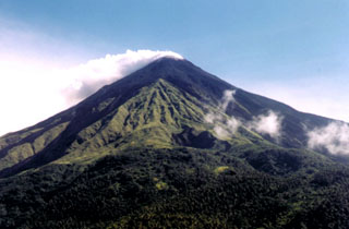
Geological Summary. Karangetang (Api Siau) volcano lies at the northern end of the island of Siau, about 125 km NNE of the NE-most point of Sulawesi. The stratovolcano contains five summit craters along a N-S line. It is one of Indonesia's most active volcanoes, with more than 40 eruptions recorded since 1675 and many additional small eruptions that were not documented (Neumann van Padang, 1951). Twentieth-century eruptions have included frequent explosive activity sometimes accompanied by pyroclastic flows and lahars. Lava dome growth has occurred in the summit craters; collapse of lava flow fronts have produced pyroclastic flows.
Information Contacts: Dali Ahmad, Volcanological Survey of Indonesia (VSI), Jalan Diponegoro No. 57, Bandung 40122, Indonesia (URL: http://www.vsi.esdm.go.id/).

