Report on Lamongan (Indonesia) — December 2003
Bulletin of the Global Volcanism Network, vol. 28, no. 12 (December 2003)
Managing Editor: Richard Wunderman.
Lamongan (Indonesia) Pilot notes 24 September ash emission, but it lacks ground confirmation
Please cite this report as:
Global Volcanism Program, 2003. Report on Lamongan (Indonesia) (Wunderman, R., ed.). Bulletin of the Global Volcanism Network, 28:12. Smithsonian Institution. https://doi.org/10.5479/si.GVP.BGVN200312-263320
Lamongan
Indonesia
7.981°S, 113.341°E; summit elev. 1641 m
All times are local (unless otherwise noted)
When last discussed in 1988 (SEAN 13:02), a seismic swarm had occurred here. Except for an uncertain 1953 eruption, 20th- and 21st-century eruptions are unknown. Darwin Volcanic Ash Advisory 2003/1 notified aircraft personnel that, on 24 September 2003, ash was visible to ~ 900 m over Lamongan.
In this 2003 case, no confirmations of a plume or other signs of volcanism were available from observers on the scene. Concrete confirmations can establish that the plume did indeed vent here, rather than at another volcano and that it did not result from similar-looking processes of non-volcanic origin (eg., forest fires, crop burning, lofted dust).
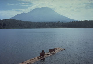
Geological Summary. Lamongan, a small stratovolcano located between the massive Tengger and Iyang-Argapura volcanic complexes, is surrounded by numerous maars and cinder cones. The currently active cone has been constructed 650 m SW of Gunung Tarub, the volcano's high point. As many as 27 maars with diameters from 150 to 700 m, some containing crater lakes, surround the volcano, along with about 60 cinder cones and spatter cones. Lake-filled maars, including Ranu Pakis, Ranu Klakah, and Ranu Bedali, are located on the E and W flanks; dry maars are predominately located on the N flanks. None of the maars has erupted during historical time, although several of the youthful maars cut drainage channels from Gunung Tarub. The volcano was very active from the time of its first historical eruption in 1799 through the end of the 19th century, producing frequent explosive eruptions and lava flows from vents on the western side ranging from the summit to about 450 m elevation.
Information Contacts: Darwin Volcanic Ash Advisory Centre (VAAC), Bureau of Meteorology, Northern Territory Regional Office, PO Box 40050, Casuarina, NT 0811, Australia (URL: http://www.bom.gov.au/info/vaac/).