Report on Saunders (United Kingdom) — March 2004
Bulletin of the Global Volcanism Network, vol. 29, no. 3 (March 2004)
Managing Editor: Richard Wunderman.
Saunders (United Kingdom) A MODIS thermal alert on 7 May 2003 (no secondary confirmation)
Please cite this report as:
Global Volcanism Program, 2004. Report on Saunders (United Kingdom) (Wunderman, R., ed.). Bulletin of the Global Volcanism Network, 29:3. Smithsonian Institution. https://doi.org/10.5479/si.GVP.BGVN200403-390090
Saunders
United Kingdom
57.8°S, 26.483°W; summit elev. 843 m
All times are local (unless otherwise noted)
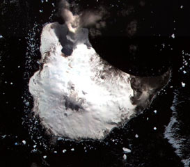
The only previous report on the remote Michael volcano was in BGVN 28:02, which commented on a lava lake detected by satellite imagery over the period 1995-2002. A review of MODIS data for the period from that report (end 2002) to 16 March 2004 (UTC) reveals one thermal alert, on 7 May 2003 (UTC). No corroborative report is available, although previous alerts were interpreted as possibly representing lava lake activity.
Geological Summary. Saunders Island consists of a large central volcanic edifice intersected by two seamount chains, as shown by bathymetric mapping (Leat et al., 2013). The young Mount Michael stratovolcano dominates the glacier-covered island, while two submarine plateaus, Harpers Bank and Saunders Bank, extend north. The symmetrical Michael has a 500-m-wide summit crater and a remnant of a somma rim to the SE. Tephra layers visible in ice cliffs surrounding the island are evidence of recent eruptions. Ash clouds were reported from the summit crater in 1819, and an effusive eruption was inferred to have occurred from a N-flank fissure around the end of the 19th century and beginning of the 20th century. A low ice-free lava platform, Blackstone Plain, is located on the north coast, surrounding a group of former sea stacks. A cluster of cones on the SE flank, the Ashen Hills, appear to have been modified since 1820 (LeMasurier and Thomson, 1990). Analysis of satellite imagery available since 1989 (Gray et al., 2019; MODVOLC) suggests frequent eruptive activity (when weather conditions allow), volcanic clouds, steam plumes, and thermal anomalies indicative of a persistent, or at least frequently active, lava lake in the summit crater. Due to this observational bias, there has been a presumption when defining eruptive periods that activity has been ongoing unless there is no evidence for at least 10 months.
Information Contacts: Rob Wright, Luke Flynn, and Eric Pilger; MODIS Thermal Alert System, Hawaii Institute of Geophysics and Planetology (HIGP), School of Ocean and Earth Science and Technology, University of Hawaii at Manoa (URL: http://modis.higp.hawaii.edu/).