Report on Bagana (Papua New Guinea) — May 2004

Bulletin of the Global Volcanism Network, vol. 29, no. 5 (May 2004)
Managing Editor: Richard Wunderman.
Bagana (Papua New Guinea) Block-lava flows descend flanks and raise concern for settlers
Please cite this report as:
Global Volcanism Program, 2004. Report on Bagana (Papua New Guinea) (Wunderman, R., ed.). Bulletin of the Global Volcanism Network, 29:5. Smithsonian Institution. https://doi.org/10.5479/si.GVP.BGVN200405-255020
Bagana
Papua New Guinea
6.137°S, 155.196°E; summit elev. 1855 m
All times are local (unless otherwise noted)
The Rabaul Volcano Observatory (RVO) received a report on 28 April from a pilot of the Hevi Lift helicopter company stating that new lava had come from Bagana volcano the day before. RVO has had no monitoring equipment at Bagana since 1989. Although they hope to again install monitoring instruments in the future, they could not confirm the visual observations instrumentally.
Bagana has been in long-term eruption since 1972, although reports ceased in 1995 because of political and economic unrest. MODIS satellite observations began in 2000, and almost monthly thermal alerts have been recorded since September 2000.
According to a news article, on 2 May local volcanologists and a team of provincial disaster delegates conducted an aerial inspection of the area around Bagana. At that time, the team concluded that the lava flows were not an immediate threat to the safety of villagers near the volcano. According to news reports a spokesperson for Papua New Guinea's national Disaster Center said the aerial inspection team noted a continual effusion of lava flowing in a southwesterly direction, but there was a great deal of vegetation in the area which acted as a buffer.
A later news article also noted that in the long term the lava flows could expose local hamlets to danger. The hamlets were constructed in the 1990s by people displaced by civil unrest.
RVO staff sent a series of photos and brief notes regarding their visit. Ima Itikarai commented that during his trip clouds affected the quality of the photos. Figure 3 shows a hamlet, which sits 3 km from the active block-lava flow front and 6.5 km from the summit, well within reach of pyroclastic flows similar to those in 1952, 1960, and 1966.
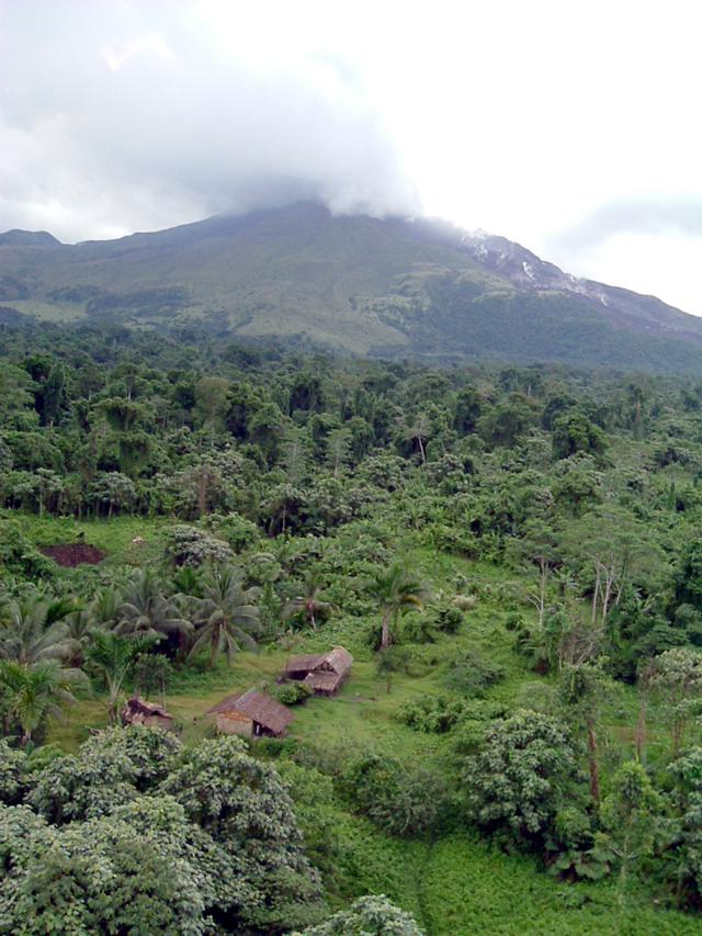 |
Figure 3. An overview of the scene on the SW region surrounding Bagana illustrating a potentially threatened hamlet and the erupting volcano and block-lava flow in the background. Courtesy of Ima Itikarai, RVO. |
At about the same time but in clearer weather, another photographer, Peter Mildner, took the photo in figure 4. It shows Bagana's summit and the active block-lava flow at a point where the levees had become 'bank full.' Figure 5 shows the lava flow pouring over the levees at various points. The lava flow's toe was also being overridden.
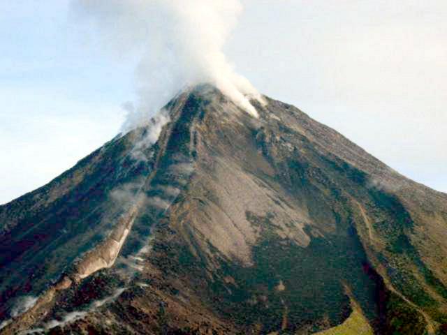 |
Figure 4. Bagana summit and upper flanks as seen in April 2004 showing the active block-lava flow on the SW side (steaming, at left center). A second block-lava flow path may have begun to descend the leveed banks on the right (note abundant steam on upper right-hand slopes). Copyrighted photo by Peter Mildner provided courtesy of Ima Itikarai, RVO. |
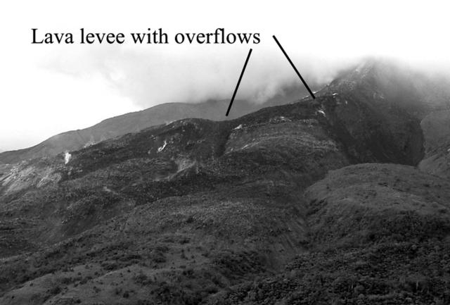 |
Figure 5. Closer view of the block-lava flow down Bagana's SW flank taken in April or May 2004, on a day with considerable low clouds. The initially confined lava flow followed the leveed path and then began to escape at several places. The fresh block lava's darker color stands in mild contrast to sparsely vegetated, older levee banks, which have a speckled appearance. Courtesy of Ima Itikarai, RVO. |
Geological Summary. Bagana volcano, in a remote portion of central Bougainville Island, is frequently active. This massive symmetrical cone was largely constructed by an accumulation of viscous andesitic lava flows. The entire edifice could have been constructed in about 300 years at its present rate of lava production. Eruptive activity is characterized by non-explosive effusion of viscous lava that maintains a small lava dome in the summit crater, although occasional explosive activity produces pyroclastic flows. Lava flows with tongue-shaped lobes up to 50 m thick and prominent levees descend the flanks on all sides.
Information Contacts: Ima Itikarai and Herman Patia, Rabaul Volcano Observatory (RVO), P.O. Box 386, Rabaul, Papua New Guinea; Papua New Guinea Post-Courier; The National; The Australian.