Report on Yasur (Vanuatu) — July 2004
Bulletin of the Global Volcanism Network, vol. 29, no. 7 (July 2004)
Managing Editor: Richard Wunderman.
Yasur (Vanuatu) Elevated seismic and eruptive activity after March 2004; emissions from three vents
Please cite this report as:
Global Volcanism Program, 2004. Report on Yasur (Vanuatu) (Wunderman, R., ed.). Bulletin of the Global Volcanism Network, 29:7. Smithsonian Institution. https://doi.org/10.5479/si.GVP.BGVN200407-257100
Yasur
Vanuatu
19.532°S, 169.447°E; summit elev. 361 m
All times are local (unless otherwise noted)
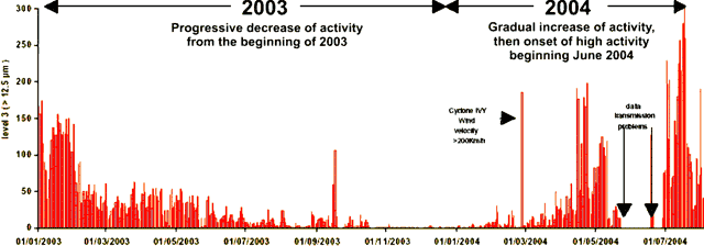
At the end of June 2004, Yasur volcano started a new cycle of high activity, the fifth since continuous monitoring began in 1993. This cycle is expected to last several months. Having reached a climax in 2002, a lessening of activity had been observed throughout 2003. A return of elevated activity was noted in March 2004, heralding the cycle that began toward the end of June (figure 35). The bulk of the seismic record (over 95%) measured by a station located 2 km from the crated represented vertical ground-movement greater than 60 mm. The increase-decrease cycle is clearly visible. Unfortunately, problems with the power supply of the station's transmitter interrupted the flow of data at the time of onset of high activity.
The new cycle of high activity that began in late June 2004 was accompanied by ash ejection. Ash fall reached several millimeters in thickness at distances up to 4 km from the vents. The cycle was linked to the reopening of the three main channels feeding vents A, B, and C, and the consequent re-emergence of emissions at all three vents.
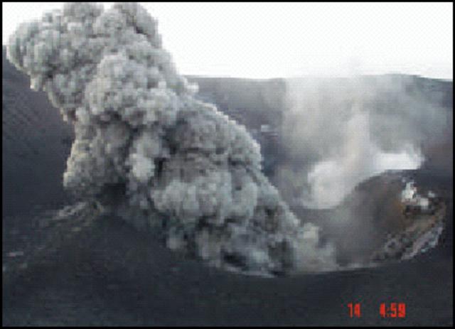
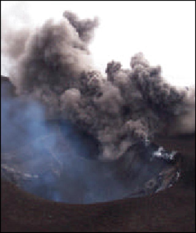
Fieldwork was conducted on Tanna Island during 10-15 July 2004. Vent A exhibited large ash plumes and low-intensity explosions (figures 36 and 37), with lava bombs ejected toward an area NW of the crater. Strombolian activity was observed at vent B (figure 38). This was the most explosive of the vents, with lava bombs projected vertically more than 300 m above the crater rim. The plume's bluish color was quite visible, confirming the presence of SO2. A wall of scoria at vent C, present now for several years, separates this vent from vents A and B. Lava ejections from vent C did not extend beyond the lip of the vent. Very dense ash plumes were emitted, but their intensity decreased after 10-11 July. From 11 to 15 July, the scientists measured SO2 concentration using a Mini Doas spectrometer and calculated a daily output of SO2 of around 1,000 metric tons per day, twice the amount measured in April 2004.
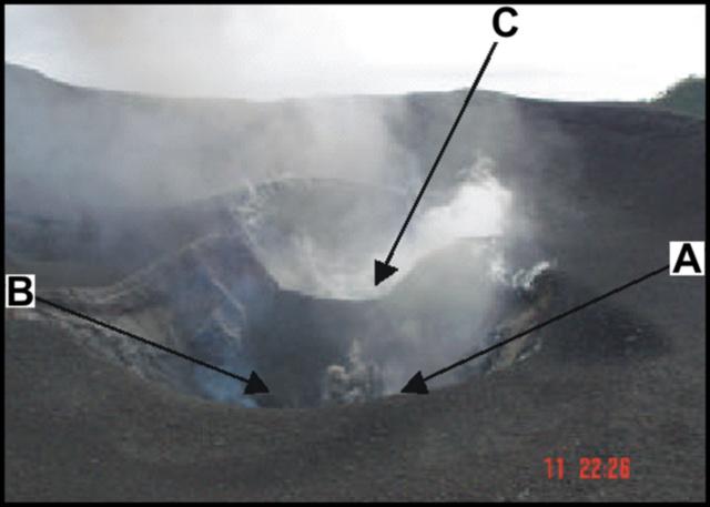 |
Figure 36. An overview of Yasur's crater on 11 July 2004. Vents are labeled and show typical activity seen during the visit. Copyrighted photo credited to M. Lardy, IRD. |
Geological Summary. Yasur has exhibited essentially continuous Strombolian and Vulcanian activity at least since Captain Cook observed ash eruptions in 1774. This style of activity may have continued for the past 800 years. Located at the SE tip of Tanna Island in Vanuatu, this pyroclastic cone has a nearly circular, 400-m-wide summit crater. The active cone is largely contained within the small Yenkahe caldera, and is the youngest of a group of Holocene volcanic centers constructed over the down-dropped NE flank of the Pleistocene Tukosmeru volcano. The Yenkahe horst is located within the Siwi ring fracture, a 4-km-wide open feature associated with eruption of the andesitic Siwi pyroclastic sequence. Active tectonism along the Yenkahe horst accompanying eruptions has raised Port Resolution harbor more than 20 m during the past century.
Information Contacts: Michel Lardy and Philipson Bani, IRD (Institut de Recherche pour le Développement) UMR Magmas et Volcans, BP A5 98848 Nouméa Cedex, New Caledonia; Jeanne Tabbagh, DGA (Département de Géophysique Appliquée), Université Paris VI, 4 Place Jussieu 75252, Paris Cedex 05, France; Esline Garaebiti, Department of Geology, Mines and Water Resources (DGMWR), PMB 01, Port- Vila, Vanuatu.

