Report on Kie Besi (Indonesia) — July 2009
Bulletin of the Global Volcanism Network, vol. 34, no. 7 (July 2009)
Managing Editor: Richard Wunderman.
Kie Besi (Indonesia) Seismicity increased during May 2009 after tectonic earthquakes
Please cite this report as:
Global Volcanism Program, 2009. Report on Kie Besi (Indonesia) (Wunderman, R., ed.). Bulletin of the Global Volcanism Network, 34:7. Smithsonian Institution. https://doi.org/10.5479/si.GVP.BGVN200907-268070
Kie Besi
Indonesia
0.32°N, 127.4°E; summit elev. 1357 m
All times are local (unless otherwise noted)
Makian remained in repose as tectonic earthquakes striking the region preceded a cluster of volcanic earthquakes during May and early June 2009. Makian lies SW of the S-central portion of Halmahera Island (in the province of Maluku Utara). Some local residents refer to the island as Mt. Kie Besi; however, it is better known under the name of Mt. Makian (other variants include Kie Besi, Makjan, Makyan, and Wakiong).
The last eruption of Makian occurred in 1988 (SEAN 13:07, 13:08, 13:10, and 13:11) and created a volcanic dome or plug on the crater floor with a diameter of 600 m and volume of ~ 282,600 m3. The 1988 eruption led to the temporary evacuation of the island's 15,000 residents (SEAN 13:07). Not previously discussed in the Bulletin, the TOMS image archive shows several SO2 clouds from the 1988 eruption (during 30 July-5 August 1988) as well as visible and infrared imagery (Sawada, 1994).
The following information was translated from a Center of Volcanology and Geological Hazard Mitigation (CVGHM) report dated 17 July 2009. Authorities raised the hazard status on 2 June 2009 (from normal, Alert Level 1 to 2) due to the following seismic and other observations.
The pattern of earthquakes and tremor, high for most of May 2009, decreased rapidly after the 28th (table 2). Hot explosions continued until at least mid-June from sulfurous vents on the S side of the lava dome. Emissions from these vents were off-white, with weak pressure, and they fed a plume reaching ~ 10 m above the peak.
Table 2. Seismicity recorded at Makian during 1 May-3 June 2009. Courtesy of Center of Volcanology and Geological Hazard Mitigation (CVGHM).
| Date | Deep volcanic earthquakes | Shallow volcanic earthquakes | Maximum tremor amplitude |
| 01-28 May 2009 | 43 (2/day avg.) | 18 (1/day avg.) | 0.5-1 mm |
| 29-31 May 2009 | 7 (2/day avg.) | 13 (4/day avg.) | 0.5-8 mm |
| 01 June 2009 | 1 | 1 | 0.5-6 mm |
| 02-03 June 2009 | 1-10/day | 1-4/day | -- |
An increase in tectonic earthquakes in the Maluku Utara (N Moluccas) region preceded the increased activity at Makian. No recent morphological changes have been observed. Based on observations up to 30 June 2009, the hazard status was downgraded to Alert Level 1 on 16 July. However, authorities still prohibited people from climbing to the peak.
The MODVOLC system had no recorded thermal alerts from Makian from at least the beginning of 2000 through August 2009.
Reference. Sawada, Y, 1994, Tracking of Regional Volcanic Ash Clouds by Geostationary Meteorological Satellite, in Volcanic Ash and Aviation Safety: Proceedings of the First International Symposium on Volcanic Ash and Aviation Safety, edited by Thomas J. Casadevall, U.S. Geological Survey Bulletin 2047.
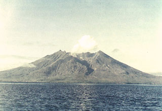
Geological Summary. Kie Besi volcano, forming the 10-km-wide Makian island off the west coast of Halmahera, has been the source of infrequent, but strong eruptions that have devastated villages on the island. The large 1.5-km-wide summit crater, containing a small lake on the NE side, gives the peak a flat-topped profile. Two prominent valleys extend to the coast from the summit crater on the north and east sides. Four cones are found on the western flanks. Eruption have been recorded since about 1550; major eruptions in 1646, 1760-61, 1861-62, 1890, and 1988 caused extensive damage and many fatalities.
Information Contacts: Center of Volcanology and Geological Hazard Mitigation (CVGHM), Jalan Diponegoro 57, Bandung 40122, Indonesia (URL: http://vsi.esdm.go.id/); Hawai'i Institute of Geophysics and Planetology (HIGP) Thermal Alerts System, School of Ocean and Earth Science and Technology (SOEST), Univ. of Hawai'i, 2525 Correa Road, Honolulu, HI 96822, USA (URL: http://modis.higp.hawaii.edu/).