Report on Telica (Nicaragua) — August 2009

Bulletin of the Global Volcanism Network, vol. 34, no. 8 (August 2009)
Managing Editor: Richard Wunderman.
Telica (Nicaragua) Extensive degassing and sporadic ash explosions during 2006-2008
Please cite this report as:
Global Volcanism Program, 2009. Report on Telica (Nicaragua) (Wunderman, R., ed.). Bulletin of the Global Volcanism Network, 34:8. Smithsonian Institution. https://doi.org/10.5479/si.GVP.BGVN200908-344040
Telica
Nicaragua
12.606°N, 86.84°W; summit elev. 1036 m
All times are local (unless otherwise noted)
Activity at Telica during the second half of 2003 through January 2005 included incandescence and occasional ash explosions, after which only crater wall collapses and degassing occurred for the remainder of 2005 (BGVN 34:06). High seismicity and fumarolic activity continued in 2006, until a brief tremor episode accompanied by ash explosions in early August. Ash explosions during 2007 were reported in January-February, June, and October-November. Most observations in 2008 described degassing, but ash emissions were noted in February and July. The Nicaraguan Territorial Studies Institute (INETER) monitors activity; visits to the crater described below are by INETER staff.
Activity during 2006. Seismicity during January-November 2006 remained high, in the range of about 3,000-6,000 micro-earthquakes/month (100-200/day). Collapses in the southern part of the crater were seen during a visit on 18 April, along with new fumarole locations in that area and one new fumarole on the N side. Similar activity, with strong gas emmissions occurred on 27 April.
An unusual tremor episode that began on 3 August prompted a visit by INETER scientists the next day. The team found that small ash explosions on 4 August were coming from a new vent that had opened in the W part of the crater. Incandescent rocks were also being ejected. Ashfall was reported in the communities of Cristo Rey and Las María, NW of the volcano. In addition, gas emissions were rising from the area of an opening, since covered by landslides, that formed in May 1999. Tremor ended on the 5th, but another ash-and-gas explosion was reported on 6 August. Two more new fumaroles, in the N and W part of the crater floor, were seen on 6 and 28 September.
Seismicity changed character on 25 November, with increased tremor and volcano-tectonic earthquakes. The high but variable seismic activity continued during December, when micro-earthquakes were recorded at a rate of about 400/day. Small seismically-detected explosions took place on 11 and 27 December, although the amount of ash and it's distribution was not known.
Activity during 2007. The high levels of seismicity and swarm episodes that began in November 2006 declined during February 2007. Micro-earthquakes averaged 80-135/day in January-February. A small phreatic explosion was recorded on 9 January, followed on the 10th by explosions of gas and ash. The plume on 9 January reached an initial altitude of 1.5 km (500 m above the summit) and drifted W before rising further. More small explosions occurred on 6, 15, and 17 February. Continuous ash emissions rising to 1.5 km altitude were visible on a webcam during the 15 February activity; satellite imagery showed a plume drifting SW and a thermal hotspot at the summit.
Daily micro-earthquake counts throughout the rest of the year ranged from 64 to 180, until the seismic station ceased operating in December. INETER observers at the crater on 12 June saw abundant gas emissions from multiple areas within the crater, and explosions that may have contained ash. During a visit on 14 August landslides were noted from the NW side of the crater walls, as were 50-cm cracks in the S wall. Large volumes of gray gas emissions were reportedly causing acid rain damage to local vegetation, and affecting area residents. Sporadic gas-and-ash explosions were reported in the last week of October and during November, causing ashfall in Quezalguaque and other locations around the volcano.
Activity during 2008. A fieldwork visit to the crater on 16 January 2008 revealed only gas emissions with jet sounds; a local resident reported similar observations. A farmer near the volcano reported to INETER that there was a heavy outflow of gas and ash on 18 February that affected the W and NW flanks; by the time of a 22 February visit only gas emissions were occurring. Gas emissions accompanied by jetting sounds were the only activity noted during subsequent visits on 10 March and 25 April. Small gas-and-ash explosions took place in early July. However, again only gas output was observed during crater visits on 22 July, 18 August, 9 September, 26 November, and 16 December (figure 16).
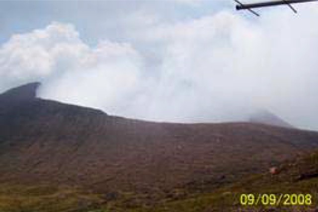 |
Figure 16. Strong gas emissions from Telica, September 2008. Courtesy of INETER. |
Seismic data began being reported again in February 2008. Average daily micro-earthquake counts, reported monthly, were 90-150 from February through July. August seismicity was not reported, but there were only 80 events/day in September, and 50 events/day in October. The seismograph was not operational in November or December.
Geological Summary. Telica, one of Nicaragua's most active volcanoes, has erupted frequently since the beginning of the Spanish era. This volcano group consists of several interlocking cones and vents with a general NW alignment. Sixteenth-century eruptions were reported at symmetrical Santa Clara volcano at the SW end of the group. However, its eroded and breached crater has been covered by forests throughout historical time, and these eruptions may have originated from Telica, whose upper slopes in contrast are unvegetated. The steep-sided cone of Telica is truncated by a 700-m-wide double crater; the southern crater, the source of recent eruptions, is 120 m deep. El Liston, immediately E, has several nested craters. The fumaroles and boiling mudpots of Hervideros de San Jacinto, SE of Telica, form a prominent geothermal area frequented by tourists, and geothermal exploration has occurred nearby.
Information Contacts: Wilfried Strauch, Instituto Nicaraguense de Estudios Territoriales (INETER), Apartado Postal 2110, Managua, Nicaragua (URL: http://www.ineter.gob.ni//geofisica.html); Washington Volcanic Ash Advisory Center, Satellite Analysis Branch (SAB), NOAA/NESDIS E/SP23, NOAA Science Center Room 401, 5200 Auth Rd, Camp Springs, MD 20746, USA (URL: http://www.ospo.noaa.gov/Products/atmosphere/vaac/).