Report on Bagana (Papua New Guinea) — February 2010
Bulletin of the Global Volcanism Network, vol. 35, no. 2 (February 2010)
Managing Editor: Richard Wunderman.
Bagana (Papua New Guinea) Occasional thermal alerts from possible lava flows during early 2010
Please cite this report as:
Global Volcanism Program, 2010. Report on Bagana (Papua New Guinea) (Wunderman, R., ed.). Bulletin of the Global Volcanism Network, 35:2. Smithsonian Institution. https://doi.org/10.5479/si.GVP.BGVN201002-255020
Bagana
Papua New Guinea
6.137°S, 155.196°E; summit elev. 1855 m
All times are local (unless otherwise noted)
A report issued in October 2009 (Arumba, 2009) described Bagana as the most active in Papua New Guinea due to its sub-continuous effusive activity, which continued in 2009. "The effusive emissions of lava from the summit crater rolled down the western flanks of the volcano. The volume of lava was too insignificant to cause any alarm." The volcano is andesitic and its lava flows tend to be ten's of meters thick. Parks (1948) photographed Bagana in eruption, and Blake (1968) discussed its geology.
Emission of lava flows, intermittent ash plumes, and thermal anomalies that were evident through December 2009 (BGVN 34:11). Reports from the Rabaul Volcano Observatory (RVO) indicated activity continuing through February 2010.
According to RVO the S-flank lava flow resumed in January 2010, and there was occasional roaring and booming from the main vent. On 5 February observers saw dense gray eruption clouds, presumably signifying ash. Weak glow was seen on the nights of 2, 12, 13, and 19 February. For the rest of the month, variable volumes of white vapor were released from the summit vents;no noises were heard.
MODIS/MODVOLC thermal alerts continued. Alerts were recorded on 13, 24, 29, and 31 January; 7, 10, 14, and 19 February; and 16 March 2010. On 16 March, the Terra satellite recorded four hot pixels.
References. Arumba, J., 2009, Agenda Item 3, Coordinating Committee for Geoscience Programmes in East and Southeast Asia (CCOP), 46th CCOP Annual Session, 18-23 October 2009, Vungtau, Vietnam; Member Country Report of Papua New Guinea, October 2009, Annual member country report, 16 p.
Blake, D.H., 1968, Post Miocene volcanoes on Bougainville Island, territory of Papua and New Guinea: Bull. Volcanology, v. 32(1), p. 121-138.
Parks, F.L. (photographer), 1948, Volcano erupts?A crater on Bougainville obliges high-ranking amateur photographer: Life Magazine, November 29, 1948, p. 42.
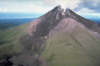
Geological Summary. Bagana volcano, in a remote portion of central Bougainville Island, is frequently active. This massive symmetrical cone was largely constructed by an accumulation of viscous andesitic lava flows. The entire edifice could have been constructed in about 300 years at its present rate of lava production. Eruptive activity is characterized by non-explosive effusion of viscous lava that maintains a small lava dome in the summit crater, although occasional explosive activity produces pyroclastic flows. Lava flows with tongue-shaped lobes up to 50 m thick and prominent levees descend the flanks on all sides.
Information Contacts: Ima Itikarai, Rabaul Volcano Observatory (RVO), PO Box 386, Rabaul, Papua New Guinea; Hawai'i Institute of Geophysics and Planetology (HIGP) Thermal Alerts System, School of Ocean and Earth Science and Technology (SOEST), Univ. of Hawai'i, 2525 Correa Road, Honolulu, HI 96822, USA (URL: http://modis.higp.hawaii.edu/).

