Report on Ibu (Indonesia) — August 2011

Bulletin of the Global Volcanism Network, vol. 36, no. 8 (August 2011)
Managing Editor: Richard Wunderman.
Ibu (Indonesia) Frequent minor white-to-gray plumes and small avalanches
Please cite this report as:
Global Volcanism Program, 2011. Report on Ibu (Indonesia) (Wunderman, R., ed.). Bulletin of the Global Volcanism Network, 36:8. Smithsonian Institution. https://doi.org/10.5479/si.GVP.BGVN201108-268030
Ibu
Indonesia
1.488°N, 127.63°E; summit elev. 1325 m
All times are local (unless otherwise noted)
Ibu (figure 9) has been intermittently active since 1998. Small explosions were noted during 2009 through January 2010 (BGVN 35:05). This report discuss seismic events from January 2011 to September 2011.
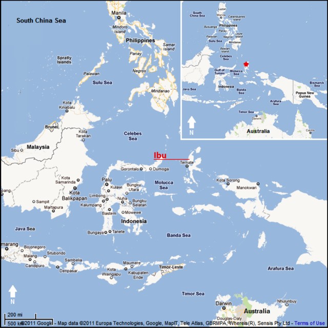 |
Figure 9. Map showing Ibu volcano, on the island of Halmahera, Indonesia. Courtesy of Google Maps (prepared by GVP editor Jeff Jessens). |
According to the Center of Volcanology and Geological Hazard Mitigation (CVGHM), during January 2011 to 8 September 2011, white-to-gray plumes rose 200-400 m above the craters. For 2011, CVGHM reported seismically detected avalanches, which on average occurred 45 times/day during January-April, 60 times/day during May-July, and 46 times/day during the first week of September. During much of 2011 seismicity fluctuated, but decreased towards September, prompting CVGHM to lower the Alert Level to 2 (on a scale of 1-4) on 8 September.
On 20 August 2011, observers from the nearby villages of Goin (exact location undisclosed) and Duono (5 km NW of Ibu) noted multiple eruptions from the S, E, and N craters. Plumes rose 50-250 m above the craters and an avalanche traveled 300 m in undisclosed direction.
During 2010, MODVOLC thermal alerts appeared about once per week on average, whereas, during 1 January 2011 through 13 September 2011, these alerts only appeared about once every 2.4 weeks on average. (Those alerts are derived from satellite data collected by the MODIS instrument and processed by the Hawai'i Institute of Geophysics and Planetology.)
Geological Summary. The truncated summit of Gunung Ibu stratovolcano along the NW coast of Halmahera Island has large nested summit craters. The inner crater, 1 km wide and 400 m deep, has contained several small crater lakes. The 1.2-km-wide outer crater is breached on the N, creating a steep-walled valley. A large cone grew ENE of the summit, and a smaller one to the WSW has fed a lava flow down the W flank. A group of maars is located below the N and W flanks. The first observed and recorded eruption was a small explosion from the summit crater in 1911. Eruptive activity began again in December 1998, producing a lava dome that eventually covered much of the floor of the inner summit crater along with ongoing explosive ash emissions.
Information Contacts: Center of Volcanology and Geological Hazard Mitigation (CVGHM), Saut Simatupang, 57, Bandung 40122, Indonesia (URL: http://vsi.esdm.go.id/); Hawai'i Institute of Geophysics and Planetology (HIGP) MODVOLC Thermal Alerts System, School of Ocean and Earth Science and Technology (SOEST), Univ. of Hawai'i, 2525 Correa Road, Honolulu, HI 96822, USA (URL: http://modis.higp.hawaii.edu/).