Report on Kama'ehuakanaloa (United States) — December 2012
Bulletin of the Global Volcanism Network, vol. 37, no. 12 (December 2012)
Managing Editor: Richard Wunderman.
Kama'ehuakanaloa (United States) Seismic swarms during 2001-2006
Please cite this report as:
Global Volcanism Program, 2012. Report on Kama'ehuakanaloa (United States) (Wunderman, R., ed.). Bulletin of the Global Volcanism Network, 37:12. Smithsonian Institution. https://doi.org/10.5479/si.GVP.BGVN201212-332000
Kama'ehuakanaloa
United States
18.92°N, 155.27°W; summit elev. -975 m
All times are local (unless otherwise noted)
K. H. Rubin of the University of Hawaii provided some of the following information concerning Lōʻihi volcano, noting that there hasn't been much activity reported over the last 10 years. The ocean bottom seismometer (OBS) died several months after installation in mid-1996 because the cable connecting it to land was not armored and thus failed early after deployment. However, using available seismic data from the OBS and the Hawaiian Volcano Observatory (HVO) land network, Caplan-Auerbach and others (2001), were able to develop a more precise crustal velocity model so that seismic events at Lōʻihi recorded by the land stations at Kīlauea can now be precisely located. Unfortunately, only large events (probably >M 3 or M 4) are detected.
Several papers were published on Lōʻihi by Schipper and others (2010, 2011) looking at a reworked pyroclastic section of unknown age on the summit platform and making inferences on eruptive conditions (especially on the conditions of vesiculation and fragmentation). The samples for their studies were collected during the last known geological dives to the summit by Hawaii Undersea Research Laboratory (HURL) and NOAA in 2007.
Seismic swarms during 2001-2006. The Lōʻihi website reported that a seismic swarm was detected at Lōʻihi's summit with earthquakes up to M 5.2 on 13 September 2001. Activity continued for a couple of weeks, with 4 events >M 4 at depths of 12-13 km. No >M 4 earthquakes were detected at Lōʻihi during 2002-2004. An M 4.3 earthquake occurred on 23 April 2005 at ~33 km depth beneath Lōʻihi, and earthquakes of M 5.1 and 5.4 occurred on 13 May and 17 July 2005, respectively, both at a depth of 44 km. The U.S. Geological Survey Advanced National Seismic System measured a small swarm of about 100 earthquakes (the largest 3 events were ~M 4, and between 12 and 28 km deep) that occurred beneath Lōʻihi on 7 December 2005. A more recent earthquake (estimated M 4.7) occurred on 18 January 2006, roughly midway between Lōʻihi and Pahala (on the S coast of the island of Hawaii).
References. Caplan-Auerbach, J., and Duennebier, F.K., 2001, Seismicity and Velocity Structure of Lōʻihi Seamount from the 1996 Earthquake Swarm, Bulletin of the Seismological Society of America, v. 91, no. 2, p. 178-190.
Rubin, K.H., Soule, S.A., Chadwick Jr., W.W., Fornari, D.J., Clague, D.A., Embley, R.W., Baker, E.T., Perfit, M.R., Caress, D.W., and Dziak, R.P., 2012, Volcanic eruptions in the deep sea, Oceanography, v. 25, no. 1, p. 142-157.
Schipper, C.I., White, J.D.L., and Houghton, B.F., 2010, Syn- and post-fragmentation textures in submarine pyroclasts from Lo`ihi Seamount, Hawai`i, Journal of Volcanology and Geothermal Research, v. 191, issues 3-4, p. 93-106.
Schipper, C.I., White, J.D.L., and Houghton, B.F., 2011, Textural, geochemical, and volatile evidence for a Strombolian-like eruption sequence at Lo`ihi Seamount, Hawai`i, Journal of Volcanology and Geothermal Research, v. 207, issues 1-2, p. 16-32.
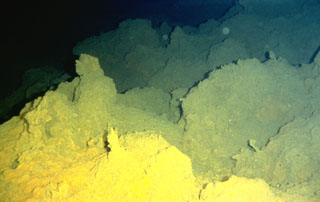
Geological Summary. The Kama’ehuakanaloa seamount, previously known as Loihi, lies about 35 km off the SE coast of the island of Hawaii. This youngest volcano of the Hawaiian chain has an elongated morphology dominated by two curving rift zones extending north and south of the summit. The summit region contains a caldera about 3 x 4 km and exhibits numerous lava cones, the highest of which is about 975 m below the ocean surface. The summit platform also includes two well-defined pit craters, sediment-free glassy lava, and low-temperature hydrothermal venting. An arcuate chain of small cones on the western edge of the summit extends north and south of the pit craters and merges into the crests prominent rift zones. Seismicity indicates a magmatic system distinct from that of Kilauea. During 1996 a new pit crater formed at the summit, and lava flows were erupted. Continued volcanism is expected to eventually build a new island; time estimates for the summit to reach the ocean surface range from roughly 10,000 to 100,000 years.
Information Contacts: Lo`ihi Volcano website (URL: http://www.soest.hawaii.edu/GG/HCV/loihi.html); K. H. Rubin, Department of Geology and Geophysics, School of Ocean and Earth Science and Technology (SOEST), University of Hawaii at Manoa, Honolulu, HI (URL: http://www/soest.hawaii.edu/GG); U.S. Geological Survey Earthquake Information Center (NEIC) (URL: https://earthquake.usgs.gov/neis); Hawaiian Volcano Observatory (HVO), U.S. Geological Survey, PO Box 51, Hawaii National Park, HI 96718, USA (URL: https://volcanoes.usgs.gov/observatories/hvo/).