Report on Villarrica (Chile) — December 2017
Bulletin of the Global Volcanism Network, vol. 42, no. 12 (December 2017)
Managing Editor: Edward Venzke.
Edited by A. Elizabeth Crafford. Research and preparation by Robert Andrews.
Villarrica (Chile) Lava lake level fluctuates and Strombolian activity persists during October 2016-November 2017
Please cite this report as:
Global Volcanism Program, 2017. Report on Villarrica (Chile) (Crafford, A.E., and Venzke, E., eds.). Bulletin of the Global Volcanism Network, 42:12. Smithsonian Institution. https://doi.org/10.5479/si.GVP.BGVN201712-357120
Villarrica
Chile
39.42°S, 71.93°W; summit elev. 2847 m
All times are local (unless otherwise noted)
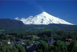
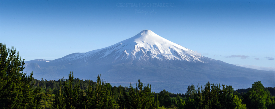
Historical eruptions at Chile's Villarrica (figure 34), documented since 1558, have consisted largely of mild-to-moderate explosive activity with occasional lava effusion. Lava flows emerging from the glacier-covered summit created deadly lahars in 1964 and 1971 (CSLP 95-71); a similar event in late 1984 led to evacuations and no fatalities occurred. Since then, an intermittently active lava lake has been the source of explosive activity, incandescence, and thermal anomalies. Renewed activity in early December 2014 was followed by a large explosion on 3 March 2015 that included a 9-km-altitude ash plume. Significant thermal anomalies from continued Strombolian activity at the lava lake and small ash emissions persisted through October 2016 (BGVN 41:11). Activity has continued during October 2016-November 2017, with information provided primarily by the Southern Andes Volcano Observatory, (Observatorio Volcanológico de Los Andes del Sur, OVDAS) part of Chile's National Service of Geology and Mining (Servicio Nacional de Geología y Minería, SERNAGEOMIN), and Projecto Observación Villarrica Internet (POVI), part of the Fundacion Volcanes de Chile, a research group that studies volcanoes across Chile.
Steam-and-gas emissions rising 200-1,000 m above the summit were observed throughout the period. The lava lake level inside the summit crater changed elevation by as much as 15 m during October 2016. Fluctuations of several meters up and down each month were reported through February 2017, and again in October 2017. Persistent minor gas-and-ash emissions, with small blocks and lapilli ejected onto the crater rim, were captured by the webcams and observed by visitors near the summit every month. Strombolian explosions and a "lava jet" sent ejecta more than 100 m above the crater rim during February 2017, and incandescent material rose 60 m above the crater rim on 1 July. Increased seismicity was detected during November 2017.
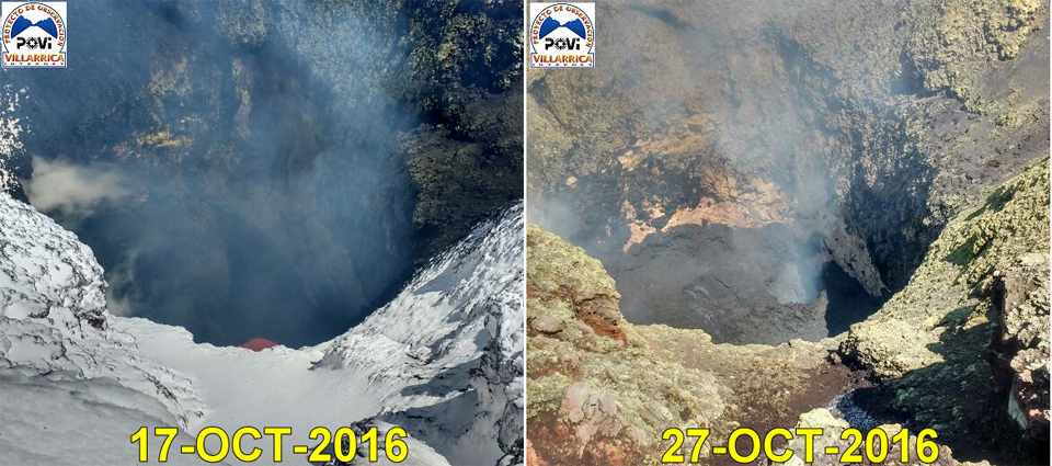
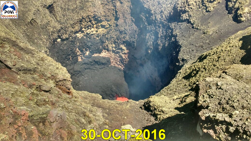
Activity during October-December 2016. Weak emissions of steam, gases, and volcanic ash near the summit were visible in the webcam during October 2016. The Buenos Aires Volcanic Ash Advisory Center (VAAC) noted a pilot report of an ash plume moving NNW on 20 October 2016 at 3.7 km altitude, slightly less than a kilometer above the summit. OVDAS reported that during the month, steam plumes rose less than 700 m and incandescence was visible at night when weather conditions permitted viewing of the summit. The MODVOLC thermal anomaly system issued 11 alerts during October. During several visits to the summit that month, POVI scientists observed that the lava lake had risen 15 m (figure 35) to a level that had been previously observed on 18 December 2015, 29 January, 28 March, and 18 September 2016. A small pyroclastic cone was visible inside the summit crater on 28 October (figure 36); by 30 October, most of it had collapsed and molten lava was again visible at the center (figure 37).
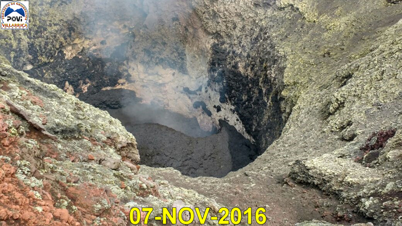
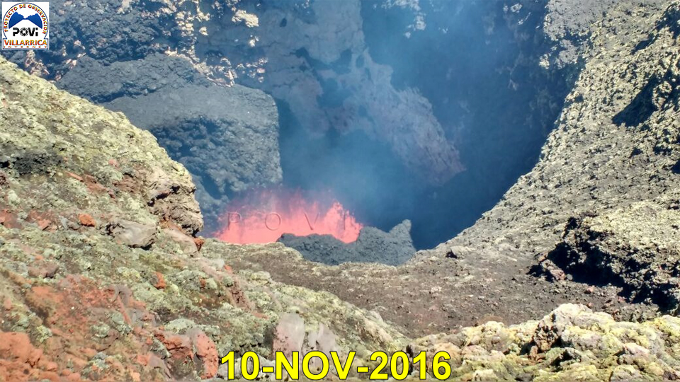
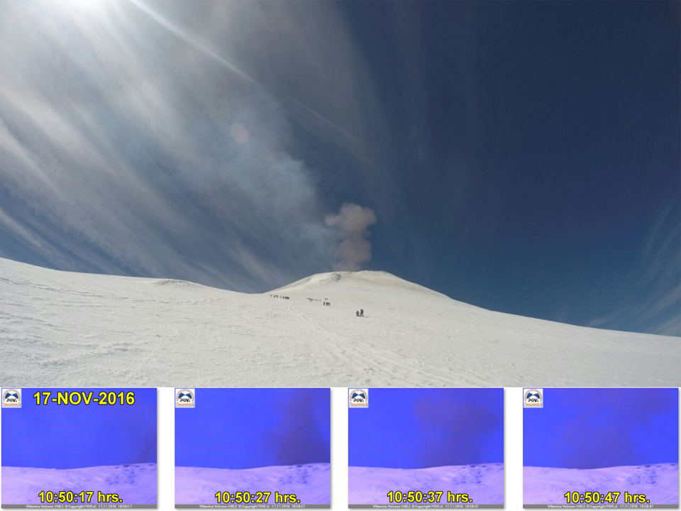
During November and December 2016, steam emissions rose only 400 m above the crater and incandescence was only occasionally visible in the webcams at night. Thermal activity detected by satellite, however, was relatively high; MODVOLC issued twelve thermal alerts during November and nine during December. The repeated growth and destruction of small pyroclastic cones within the summit crater was well documented by several visits of POVI scientists to the summit (figures 38 and 40). They also collected bombs ejected near the crater rim (figure 39), and observed persistent minor ash-and-gas emissions (figure 41).
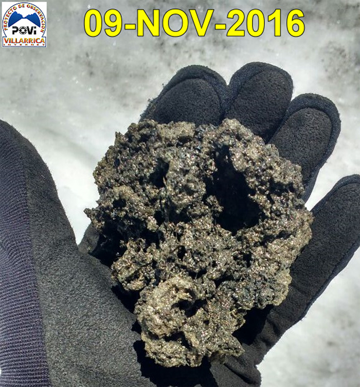 |
Figure 39. A piece of ejecta collected at the edges of the summit crater at Villarrica on 9 November 2016. Courtesy of POVI (Volcán Villarrica, 27 de Octubre al 30 de Noviembre 2016). |
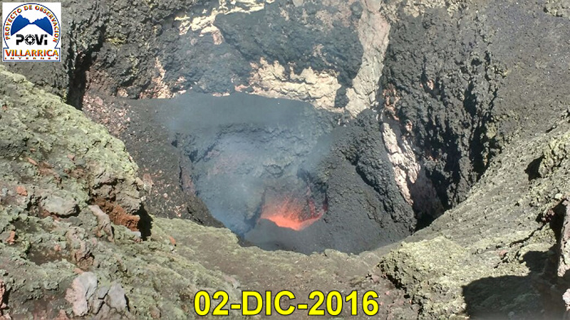
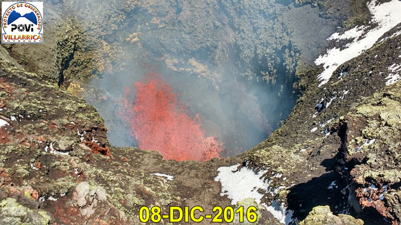
Observations by POVI scientists during December 2016 included continued evidence of cone creation and destruction in the vent (figure 42), and small lava fountains (figure 43). Strombolian explosions with bombs were recorded by the webcam on 1, 2, and 3 December. Bombs were ejected more than 50 m above the crater rim, some as large as 1.5 m in diameter. Between 2 and 3 December they observed an 8-10 m drop of the lava in the vent, leaving behind a circular depression with a small incandescent chimney on the NNW side. The webcam captured ash emissions on 2, 14, 15, 18, and 19 December.
Activity during January-May 2017. OVDAS reported nighttime incandescence and steam emissions less than 250 m high during January 2017. They were higher in February, rising 700 m above the crater rim. Six MODVOLC thermal alerts were issued in January and one in February.
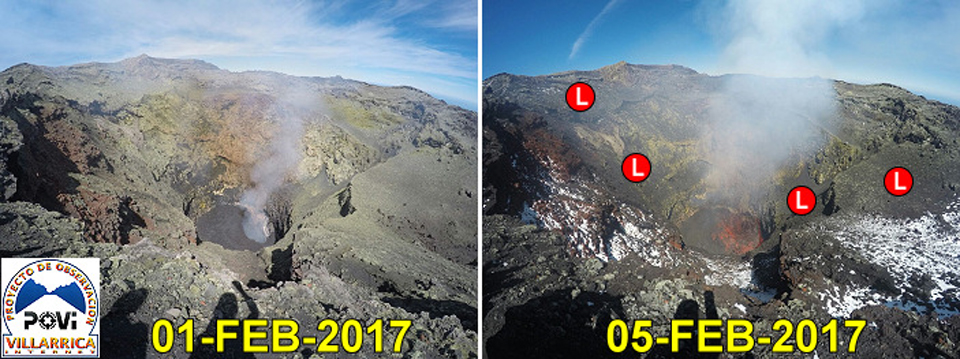
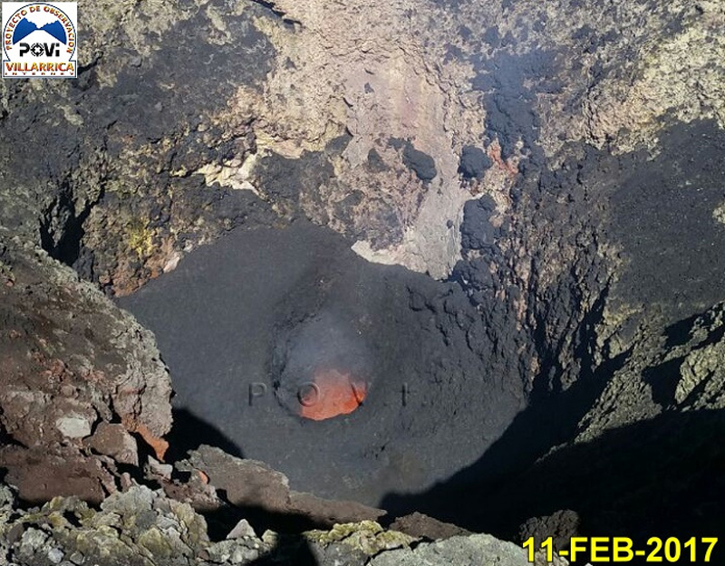
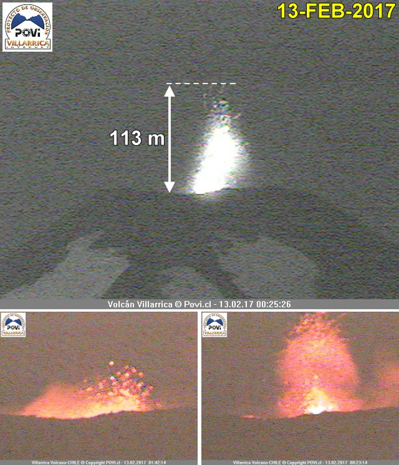
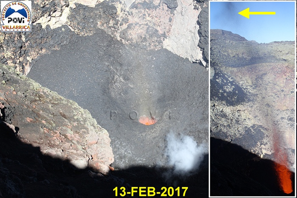
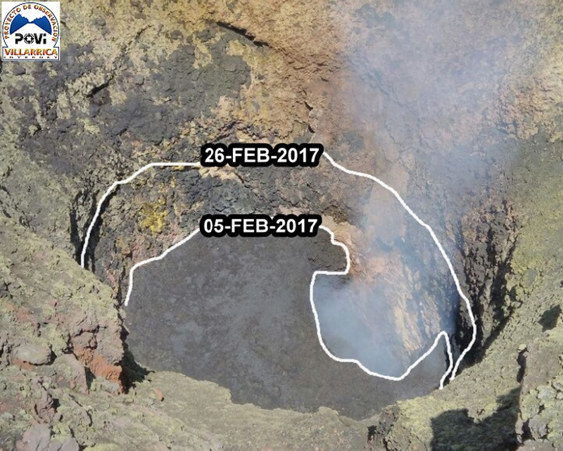
Volcanologists from POVI reported an increase in activity during February (figure 44), including a sudden collapse of about 10 m of much of the material in the lava pit on 9 February, after which a new rise began almost immediately (figure 45). During 10-15 February, explosions from a narrow vent sent lava fountains and ejecta more than 100 m high (figures 46). On 13 February, they witnessed powerful "lava jets" that rose 150 m (figure 47); bombs up to a meter in diameter were ejected 50 m from the vent and spatter covered much of the inner walls of the crater. Between 5 and 26 February, pyroclastic debris raised the level of the bottom of the crater by 10-12 m (figure 48).
During March 2017, OVDAS reported steam-and-gas emissions rising 1,000 m. They issued a special report on 23 March indicating an increase in the gas plume height and the occurrence of sporadic explosions of ballistic material that remained within the summit crater. Single MODVOLC thermal alerts were issued on 7 and 14 March 2017.
Nighttime incandescence and steam plumes rising to 550 m characterized activity reported by OVDAS during April 2017. Only a single MODVOLC thermal alert was issued on 4 April. Steam plumes were reported to only 250 m above the crater rim during May along with incandescence at night, but there were seven MODVOLC thermal alerts on four different days; 1 (2), 19 (3), 20, and 29 May.
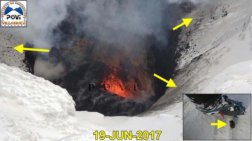
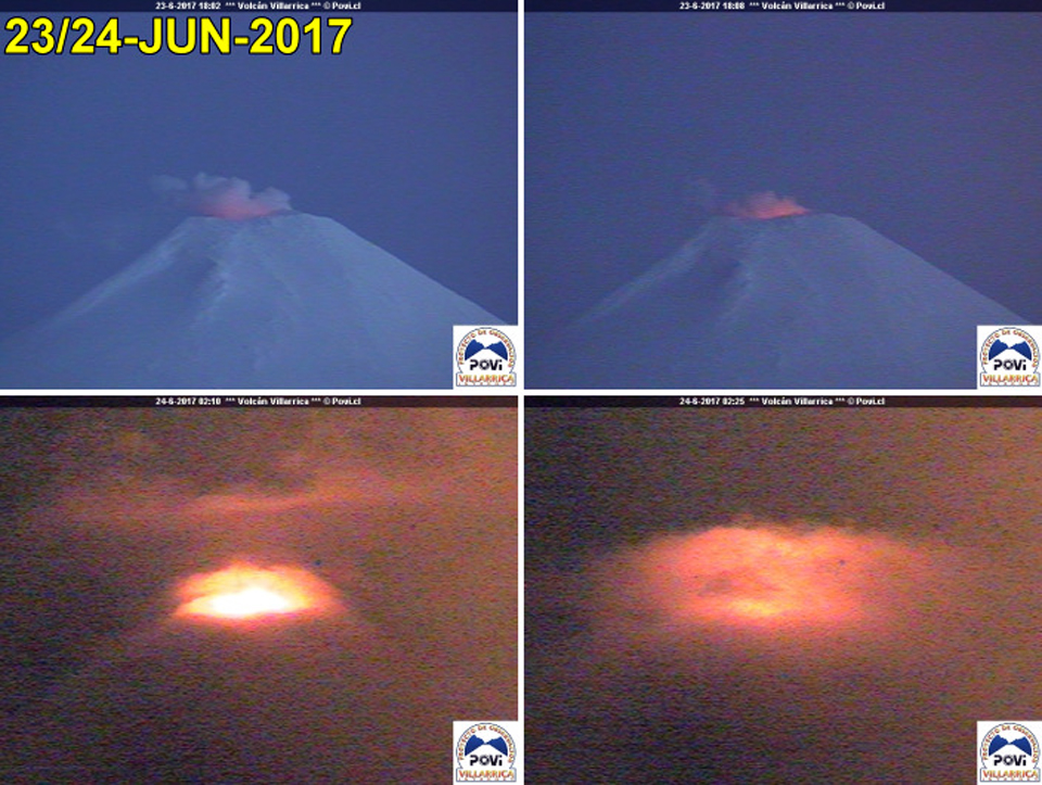
Activity during June-November 2017. OVDAS reported low levels of activity during June 2017, with incandescence at night and steam plumes rising no higher than 170 m. Only a single MODVOLC thermal alert was issued on 20 June. On a visit to the summit crater on 5 June, POVI scientists observed a 10-m-diameter vent at the bottom of the crater, and lapilli fragments 2-64 mm in diameter distributed around the crater rim. A second visit on 19 June revealed increased explosive activity at the bottom of the crater, ash deposits on the inner walls of the crater, and more lapilli around the mouth of the crater (figure 49). POVI webcams recorded a significant increase in the intensity of incandescence from the summit crater on 24 June 2017 (figure 50).
On 1 July 2017, POVI captured a webcam image of Strombolian explosions that sent incandescent material 60 m high from the summit crater. OVDAS reported steam plumes rising no more than 550 m and incandescence at night during July; there were no reported MODVOLC thermal alerts that month, and only a single alert on 30 August. OVDAS reported steam plumes during August rising to 150 m, sporadic ash and larger pyroclastic emissions around the crater rim, and nighttime incandescence.
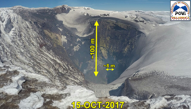
Activity decreased during September and October 2017, with continued steam emissions rising 300-500 m, minor ash emissions around the crater rim, and nighttime incandescence. Two MODVOLC thermal alerts were issued, on 4 and 16 September, and none during October. POVI scientists visited the summit during October 2017 and noted that the vent remained active, especially after 22 October. They observed that at least half of the inner walls of the crater were covered with fresh ash and lapilli, concentrated on the W, S, and NE sides. They estimated that the active vent was about 8 m in diameter, approximately 100 m down inside the crater (figure 51). The bottom of the crater appeared about 4 m higher than it was on 26 September 2017, and the vent diameter had expanded by 2 m. Ash and lapilli fragments were found around the edge of the crater on 15, 22, and 25 October. Ejections of small fragments of lava were captured by the webcam on 22 and 23 October.
OVDAS reported that during November 2017, the webcams near the summit showed evidence of low intensity, predominantly white degassing to low altitudes (100 m above the summit). Nighttime incandescence associated with occasional explosions around the crater were typical. They also noted that long-period (LP) seismicity increased in both energy amplitude and frequency during the last few days of the month. A gradual increase in RSAM values began on 15 November with a continuous tremor signal. A 4.1 magnitude event was reported on 24 November located 2.6 km ESE of the summit at a depth of 1.8 km. A single MODVOLC thermal alert was reported on 28 November.
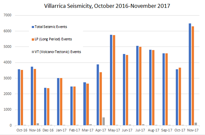
Seismicity and thermal anomalies. Seismicity at Villarrica during October 2016-November 2017 was relatively stable (figure 52), although it varied between about 2,500 and 6,500 events per month, with over 90% recorded as LP events, and only a few VT (volcano-tectonic) events. The highest frequency values occurred in May (5,749) and November 2017 (6,484).
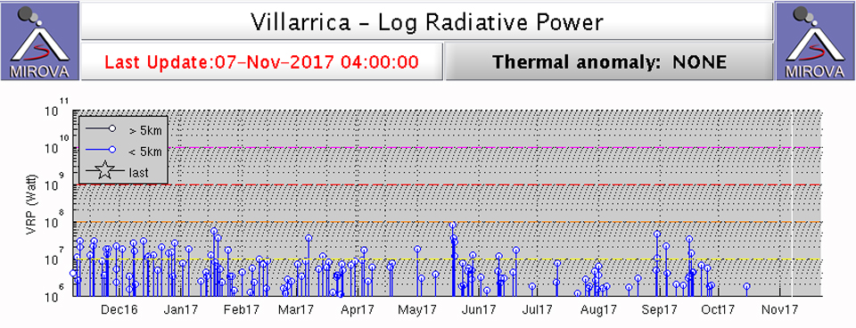
Infrared data graphed by the MIROVA system (figure 53) indicated the continuous but decreasing frequency and intensity of thermal anomalies at Villarrica between November 2016 and November 2017.
Geological Summary. The glacier-covered Villarrica stratovolcano, in the northern Lakes District of central Chile, is ~15 km south of the city of Pucon. A 2-km-wide caldera that formed about 3,500 years ago is located at the base of the presently active, dominantly basaltic to basaltic andesite cone at the NW margin of a 6-km-wide Pleistocene caldera. More than 30 scoria cones and fissure vents are present on the flanks. Plinian eruptions and pyroclastic flows that have extended up to 20 km from the volcano were produced during the Holocene. Lava flows up to 18 km long have issued from summit and flank vents. Eruptions documented since 1558 CE have consisted largely of mild-to-moderate explosive activity with occasional lava effusion. Glaciers cover 40 km2 of the volcano, and lahars have damaged towns on its flanks.
Information Contacts: Servicio Nacional de Geología y Minería, (SERNAGEOMIN), Observatorio Volcanológico de Los Andes del Sur (OVDAS), Avda Sta María No. 0104, Santiago, Chile (URL: http://www.sernageomin.cl/); Proyecto Observación Villarrica Internet (POVI) (URL: http://www.povi.cl/); Hawai'i Institute of Geophysics and Planetology (HIGP), MODVOLC Thermal Alerts System, School of Ocean and Earth Science and Technology (SOEST), Univ. of Hawai'i, 2525 Correa Road, Honolulu, HI 96822, USA (URL: http://hotspot.higp.hawaii.edu/; http://modis.higp.hawaii.edu/); Buenos Aires Volcanic Ash Advisory Center (VAAC), Servicio Meteorológico Nacional-Fuerza Aérea Argentina, 25 de mayo 658, Buenos Aires, Argentina (URL: http://www.smn.gov.ar/vaac/buenosaires/inicio.php?lang=es); MIROVA (Middle InfraRed Observation of Volcanic Activity), a collaborative project between the Universities of Turin and Florence (Italy) supported by the Centre for Volcanic Risk of the Italian Civil Protection Department (URL: http://www.mirovaweb.it/); Cristian Gonzalez G., flickr (URL:https://www.flickr.com/photos/cg_fotografia/), photo used under Creative Commons license (https://creativecommons.org/licenses/by-nd/2.0/).

