Report on Gamalama (Indonesia) — November 2018
Bulletin of the Global Volcanism Network, vol. 43, no. 11 (November 2018)
Managing Editor: Edward Venzke.
Research and preparation by Paul Berger.
Gamalama (Indonesia) Weak explosion on 4 October 2018
Please cite this report as:
Global Volcanism Program, 2018. Report on Gamalama (Indonesia) (Venzke, E., ed.). Bulletin of the Global Volcanism Network, 43:11. Smithsonian Institution. https://doi.org/10.5479/si.GVP.BGVN201811-268060
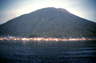
Gamalama
Indonesia
0.81°N, 127.3322°E; summit elev. 1714 m
All times are local (unless otherwise noted)
The most recent of the previous intermittent weak explosions on Gamalama was on 3 August 2016, which produced an ash plume and ashfall that closed a nearby airport for a day (BGVN 42:03). This report discusses eruptive activity in October 2018. The volcano is monitored by the Pusat Vulkanologi dan Mitigasi Bencana Geologi (PVMBG, also known as Indonesian Center for Volcanology and Geological Hazard Mitigation, CVGHM).
PVMBG reported that an explosion at 1152 on 4 October 2018, likely phreatic, generated an ash plume that rose about 250 m above the summit and drifted NW. Eight volcanic earthquakes were recorded about an hour before the event. Based on satellite data and information from PVMBG, the Darwin Volcanic Ash Advisory Centre (VAAC) reported that during 5-6 October ash plumes rose to an altitude of 2.1 km and drifted W and NW. The Alert Level remained at 2 (on a scale of 1-4); visitors and residents were warned not to approach the crater within a 1.5-km radius. On 10 October PVMBG reported only gas emissions (mostly water vapor), and the Aviation Color Code was lowered from Orange to Yellow.
No significant SO2 levels near the volcano were recorded by NASA's satellite-borne ozone instruments (Suomi NPP/OMPS and Aura/OMI) during early October. However, Simon Carn reported that the newer TropOMI instrument aboard the Copernicus Sentinel-5P satellite showed significant SO2 levels as high as 12 TRM/DU (levels in middle troposphere layer, as measured in Dobson Units) on 4 October 2018 (figure 7).
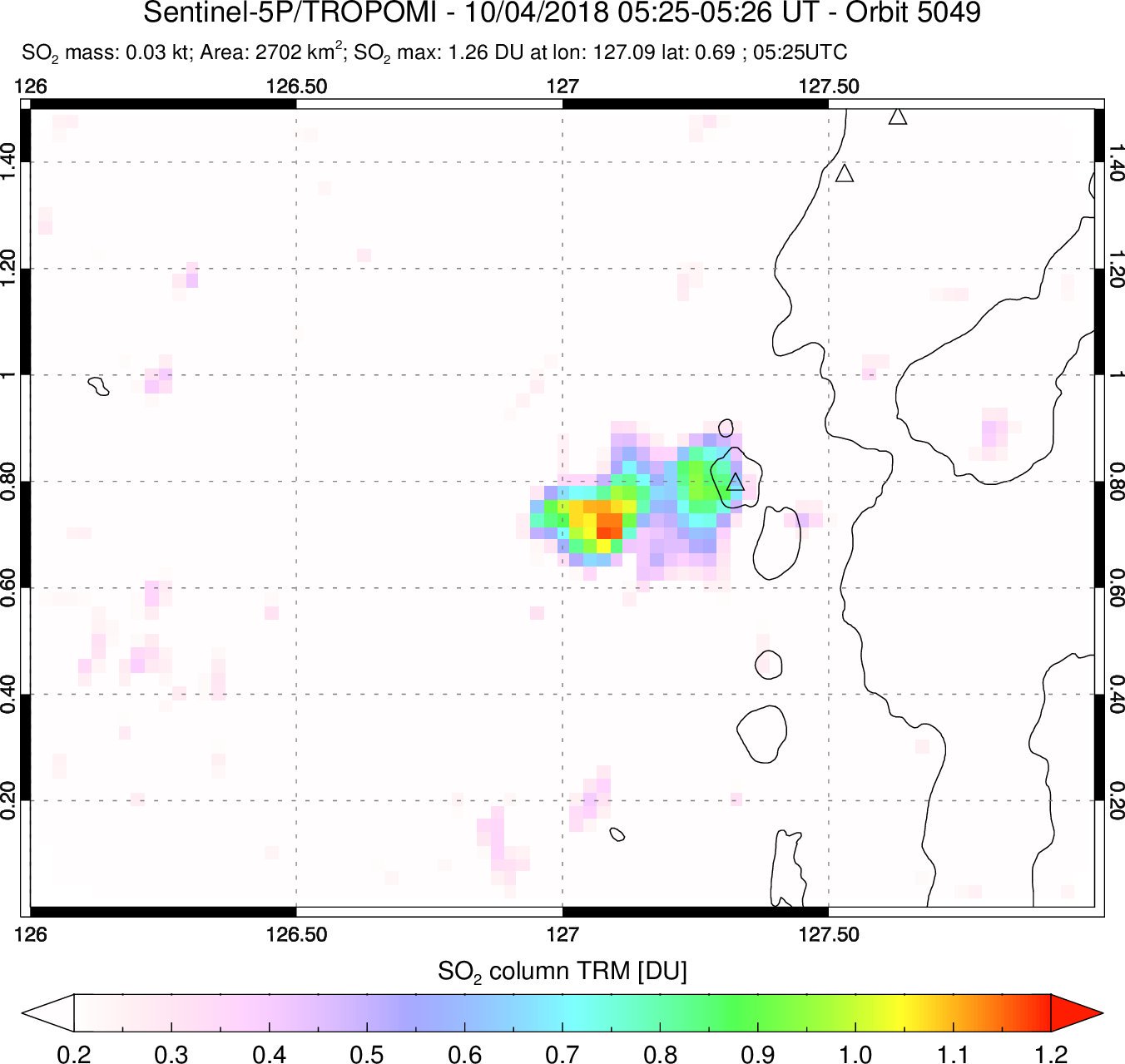 |
Figure 7. Weak SO2 emissions from Gamalama on 4 October 2018 were detected by the Sentinel-5P TROPOMI instrument. Courtesy of Simon Carn. |
Geological Summary. Gamalama is a near-conical stratovolcano that comprises the entire island of Ternate off the western coast of Halmahera, and is one of Indonesia's most active volcanoes. The island was a major regional center in the Portuguese and Dutch spice trade for several centuries, which contributed to the extensive documentation of activity. Three cones, progressively younger to the north, form the summit. Several maars and vents define a rift zone, parallel to the Halmahera island arc, that cuts the volcano; the S-flank Ngade maar formed after about 14,500–13,000 cal. BP (Faral et al., 2022). Eruptions, recorded frequently since the 16th century, typically originated from the summit craters, although flank eruptions have occurred in 1763, 1770, 1775, and 1962-63.
Information Contacts: Pusat Vulkanologi dan Mitigasi Bencana Geologi (PVMBG, also known as Center of Volcanology and Geological Hazard Mitigation (CVGHM), Jalan Diponegoro 5+7, Bandung 40122, Indonesia (URL: http://www.vsi.esdm.go.id/); Darwin Volcanic Ash Advisory Centre (VAAC), Bureau of Meteorology, Northern Territory Regional Office, PO Box 40050, Casuarina, NT 0811, Australia (URL:http://www.bom.gov.au/info/vaac/); Simon Carn, Geological and Mining Engineering and Sciences, Michigan Technological University, 1400 Townsend Drive, Houghton, MI 49931, USA (URL: http://www.volcarno.com/, Twitter: @simoncarn).