Report on Semisopochnoi (United States) — September 2019
Bulletin of the Global Volcanism Network, vol. 44, no. 9 (September 2019)
Managing Editor: Edward Venzke.
Research and preparation by Kadie Bennis.
Semisopochnoi (United States) Small explosions detected between 16 July and 24 August 2019
Please cite this report as:
Global Volcanism Program, 2019. Report on Semisopochnoi (United States) (Venzke, E., ed.). Bulletin of the Global Volcanism Network, 44:9. Smithsonian Institution. https://doi.org/10.5479/si.GVP.BGVN201909-311060
Semisopochnoi
United States
51.93°N, 179.58°E; summit elev. 1221 m
All times are local (unless otherwise noted)
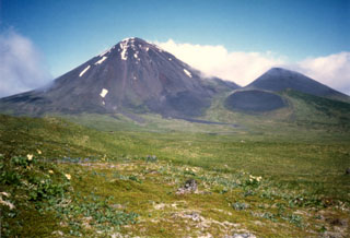
The remote island of Semisopochnoi in the western Aleutians is dominated by a caldera measuring 8 km in diameter that contains a small lake (Fenner Lake) and a number of post-caldera cones and craters. A small (100 m diameter) crater lake in the N cone of Semisopochnoi's Cerberus three-cone cluster has persisted since January 2019. An eruption at Sugarloaf Peak in 1987 included an ash plume (SEAN 12:04). Activity during September-October 2018 included increased seismicity and small explosions (BGVN 44:02). The primary source of information for this reporting period of July-August 2019 comes from the Alaska Volcano Observatory (AVO), when there were two low-level eruptions.
Seismicity rose above background levels on 5 July 2019. AVO reported that data from local seismic and infrasound sensors likely detected a small explosion on 16 July. A strong tremor on 17 July generated airwaves that were detected on an infrasound array 260 km E on Adak Island. In addition to this, a small plume extended 18 km WSW from the Cerberus vent, but no ash signals were detected in satellite data. Seismicity decreased abruptly on 18 July after a short-lived eruption. Seismicity increased slightly on 23 July and remained elevated through August.
On 24 July 2019 AVO reported that satellite data showed that the crater lake was gone and a new, shallow inner crater measuring 80 m in diameter had formed on the crater floor, though no lava was identified. Satellite imagery indicated that the crater of the Cerberus N cone had been replaced by a smooth, featureless area of either tephra or water at a level several meters below the previous floor. Satellite imagery detected faint steam plumes rising to 5-10 km altitude and minor SO2 emissions on 27 July. Satellite data showed a steam plume rising from Semisopochnoi on 18 August and SO2 emissions on 21-22 August. Ground-coupled airwaves identified in seismic data on 23-24 August was indicative of additional explosive activity.
Geological Summary. Semisopochnoi, the largest subaerial volcano of the western Aleutians, is 20 km wide at sea level and contains an 8-km-wide caldera. It formed as a result of collapse of a low-angle, dominantly basaltic volcano following the eruption of a large volume of dacitic pumice. The high point of the island is Anvil Peak, a double-peaked late-Pleistocene cone that forms much of the island's northern part. The three-peaked Mount Cerberus (renamed Mount Young in 2023) was constructed within the caldera during the Holocene. Each of the peaks contains a summit crater; lava flows on the N flank appear younger than those on the south side. Other post-caldera volcanoes include the symmetrical Sugarloaf Peak SSE of the caldera and Lakeshore Cone, a small cinder cone at the edge of Fenner Lake in the NE part of the caldera. Most documented eruptions have originated from Young, although Coats (1950) considered that both Sugarloaf and Lakeshore Cone could have been recently active.
Information Contacts: Alaska Volcano Observatory (AVO), a cooperative program of a) U.S. Geological Survey, 4200 University Drive, Anchorage, AK 99508-4667 USA (URL: https://avo.alaska.edu/), b) Geophysical Institute, University of Alaska, PO Box 757320, Fairbanks, AK 99775-7320, USA, and c) Alaska Division of Geological & Geophysical Surveys, 794 University Ave., Suite 200, Fairbanks, AK 99709, USA (URL: http://dggs.alaska.gov/).

