Raung
Indonesia
8.119°S, 114.056°E; summit elev. 3260 m
All times are local (unless otherwise noted)
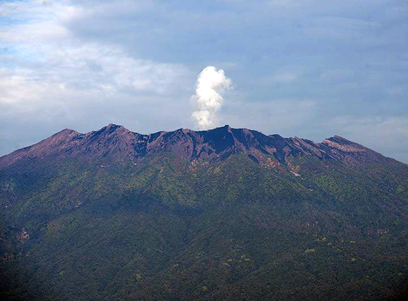
A massive stratovolcano in easternmost Java, Raung has over sixty recorded eruptions dating back to the late 16th Century. Explosions with ash plumes, Strombolian activity, and lava flows from a cinder cone within the 2-km-wide summit crater have been the most common activity. Visual reports of activity have often come from commercial airline flights that pass near the summit; Pusat Vulkanologi dan Mitigasi Bencana Geologi (PVMBG, also known as Indonesian Center for Volcanology and Geological Hazard Mitigation, CVGHM) has installed webcams to monitor activity in recent years. An eruption in 2015 produced a large volume of lava within the summit crater and formed a new pyroclastic cone in the same location as the previous one. Confirmation and details of eruptions in 2012, 2013, and 2014-2015 are covered in this report with information provided by PVMBG, the Darwin Volcanic Ash Advisory Center (VAAC), several sources of satellite data, and visitors to the volcano.
Newly available visual and satellite information confirm eruptions at Raung during October 2012-January 2013, June-July 2013, and extend the beginning of the 2015 eruption back to November 2014. The 2015 eruption was the largest in several decades; Strombolian activity was reported for many months and fresh lava flows covered the crater floor. Raung was quiet after the 2015 eruption ended in August of that year until July 2020.
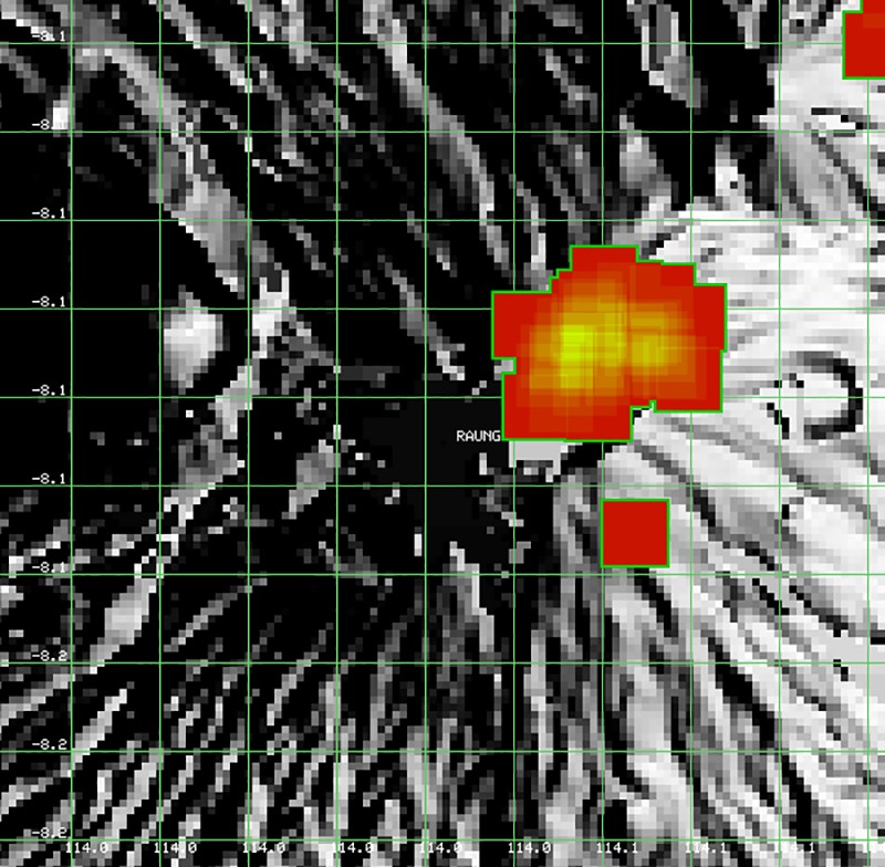
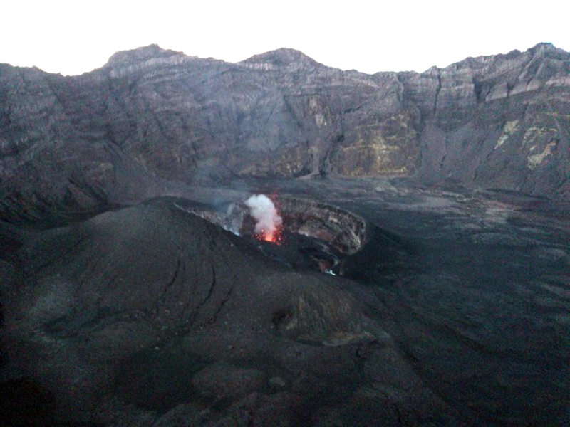
Eruption during October 2012-January 2013. A MODVOLC thermal alert appeared inside the summit crater of Raung on 14 October 2012, followed by another four alerts on 16 October. Multiple daily alerts were reported on many days through 8 November, most within the main crater. Single alerts appeared on 29 November and 1 December 2012 (figure 9). PVMBG raised the Alert Level on 17 October from 1 to 2 due to increased seismicity and raised it further to Level 3 on 22 October. A local news report by Aris Yanto indicted that a minor Strombolian eruption occurred inside the crater on 19 October. Strombolian activity was also observed inside the inner crater on 5 November 2012 by visitors (figure 10); they reported loud rumbling sounds that could be heard up to 15 km from the crater.
The Darwin VAAC issued an advisory of an eruption plume to 9.1 km altitude reported at 0237 UTC on 8 November 2012. In a second advisory about two hours later they noted that an ash plume was not visible in satellite imagery. A press article released by the Center for Volcanology and Geological Hazard Mitigation (PVMBG) indicated that gray ash plumes were observed on 6 January 2013 that rose 300 m above the summit crater rim. Incandescence was observed around the crater and thundering explosions were heard by nearby residents.
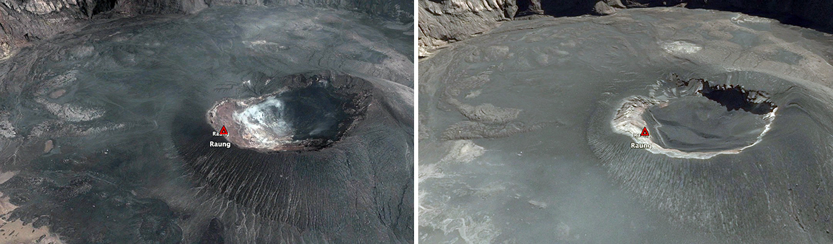
Eruption during June-July 2013. Two MODVOLC thermal alerts were measured inside the summit crater on 29 June 2013. A photo taken on 21 July showed minor Strombolian activity at the inner crater (figure 11). A weak SO2 anomaly was detected in the vicinity of Raung by the OMI instrument on the Aura satellite on 27 July. Thermal alerts were recorded on 29 and 31 July. When Google Earth imagery from 14 March 2011 created by Maxar Technologies is compared with imagery from 29 July 2013 captured by Landsat/Copernicus, dark tephra is filling the inner crater in the 2013 image; it was not present in 2011 (figure 12).
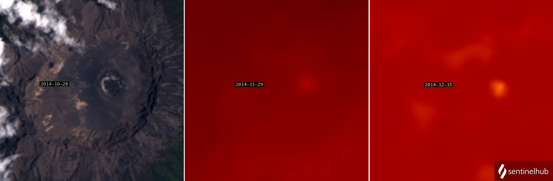
Eruption during November 2014-August 2015. Information about this eruption was previously reported (BGVN 41:12), but additional details are provided here. Landsat-8 imagery from 28 October 2014 indicated clear skies and little activity within the summit crater. Local observers reported steam plumes beginning in mid-November (figure 13). MODVOLC thermal alerts within the summit crater were issued on 28 and 30 November, and then 15 alerts were issued on seven days in December. Thermal Landsat-8 imagery from cloudy days on 29 November and 15 December indicated an anomaly over the area of the pyroclastic cone inside the summit crater (figure 14).
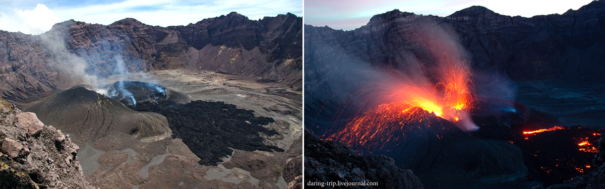
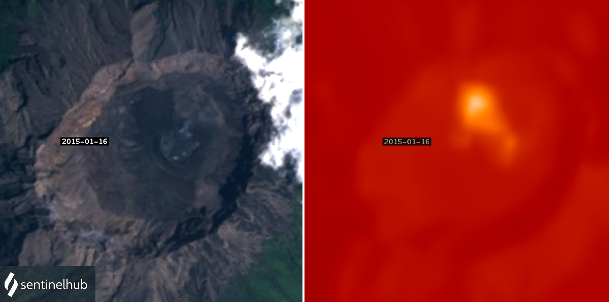
In January 2015 the MODVOLC system identified 25 thermal anomalies in MODIS data, with a peak of eight alerts on 8 January. Visitors to the summit crater on 6 January witnessed explosions from the inner crater approximately every 40 minutes that produced gas and small amounts of ash and tephra. They reported lava flowing continuously from the inner crater onto the larger crater floor, and incandescent activity was seen at night (figure 15). Landsat-8 images from 16 January showed a strong thermal anomaly covering an area of fresh lava (figure 16).
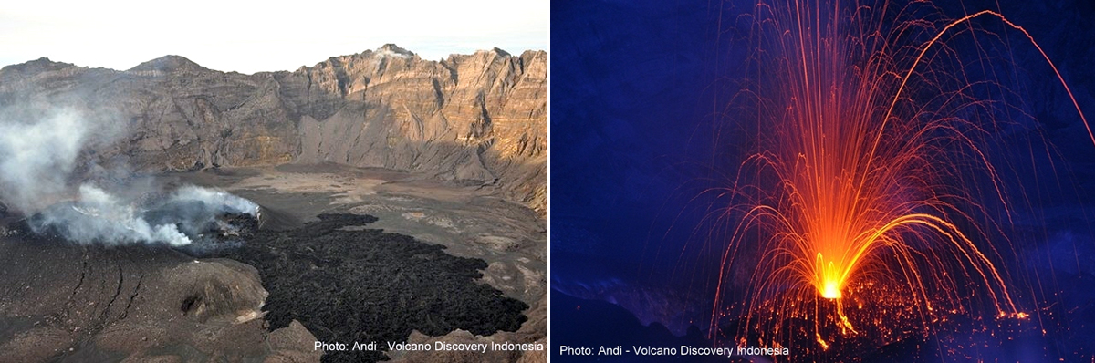
Satellite images were obscured by meteoric clouds during February 2015, but PVMBG reported gray and brown plumes rising 300 m multiple times and incandescence and rumbling on 14 February. Visitors to the summit crater during the second half of February reported Strombolian activity with lava fountains from the inner crater, at times as frequently as every 15 minutes (figure 17). Loud explosions and rumbling were heard 10-15 km away. MODVOLC thermal alerts stopped on 25 February and did not reappear until late June.
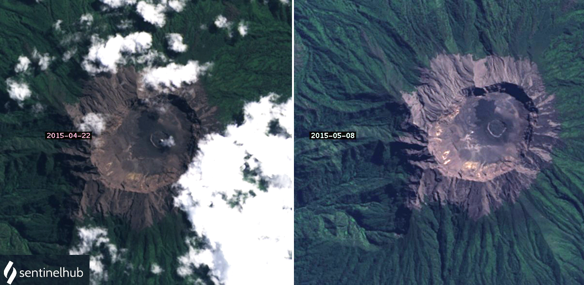
PVMBG raised the Alert Level to 2 in mid-March 2015. Weak thermal anomalies located inside and NW of the pyroclastic cone were present in satellite imagery on 21 March. PVMBG reported gray and brown emissions during March, April, and May rising as high as 300 m above the crater. Landsat imagery from 22 April showed a small emission inside the pyroclastic cone, and on 8 May showed a clearer view of the fresh black lava NW and SW of the pyroclastic cone (figure 18).
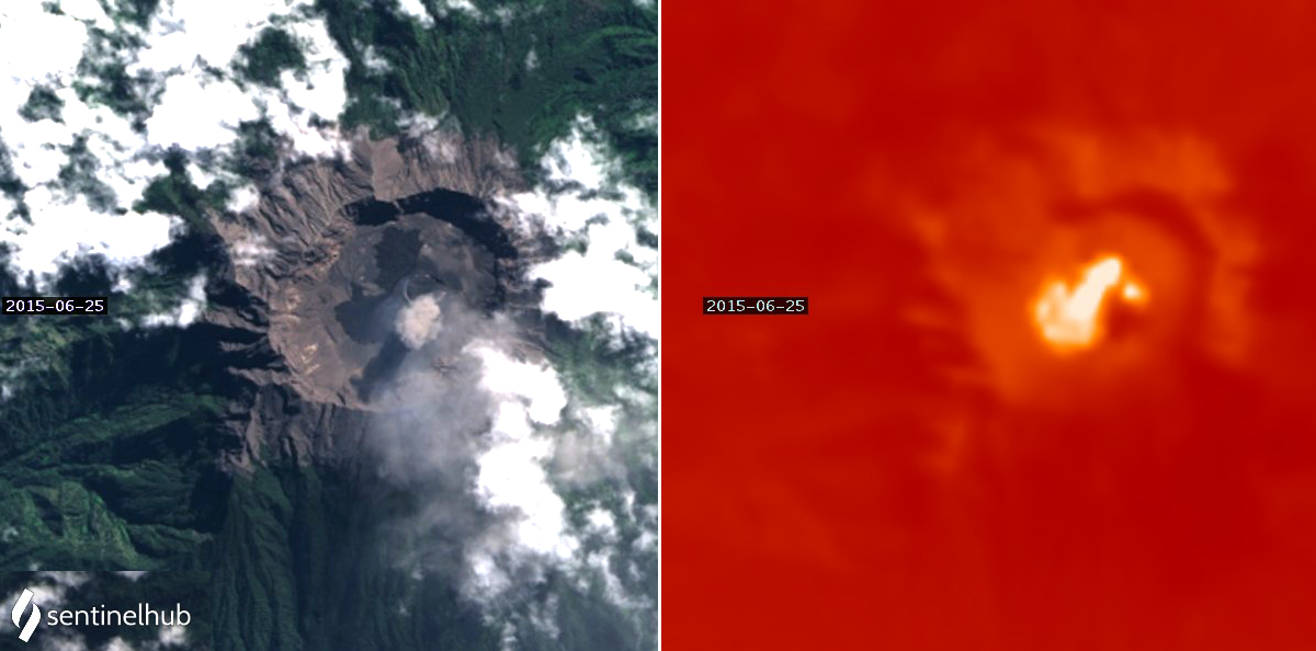
Nine MODVOLC thermal alerts appeared inside the summit crater on 21 June 2015 after no alerts since late February, suggesting an increase in activity. The Darwin VAAC issued the first ash advisory for 2015 on 24 June noting an aviation report of recent ash. The following day the Ujung Pandang Meteorological Weather Office (MWO) reported an ash emission drifting W at 3.7 km altitude. The same day, 25 June, Landsat-8 imagery clearly showed a new lava flow on the W side of the crater and a strong thermal anomaly. The thermal data showed a point source of heat widening SW from the center of the crater and a second point source of heat that appeared to be inside the pyroclastic cone. A small ash plume was visible over the cone (figure 19). Strombolian activity and ash plumes were reported by BNPB and PVMBG in the following days. On 26 June the Darwin VAAC noted the hotspot had remained visible in infrared imagery for several days. PVMBG reported an ash emission to 3 km altitude on 29 June.
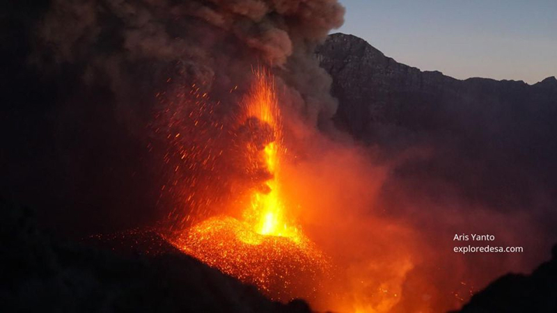
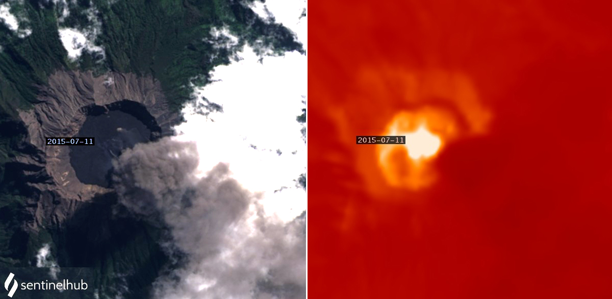
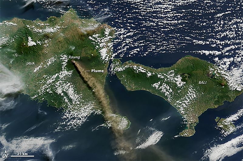
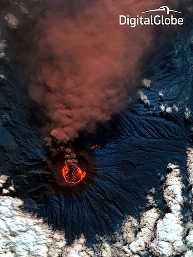
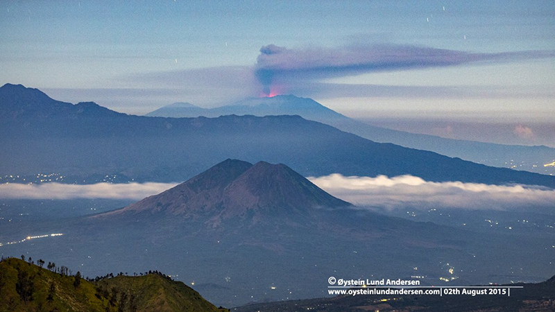
Activity increased significantly during July 2015 (BGVN 41:12). Ash plumes rose as high as 6.7 km altitude and drifted hundreds of kilometers in multiple directions, forcing multiple shutdowns at airports on Bali and Lombok, as well as Banyuwangi and Jember in East Java. The Darwin VAAC issued 152 ash advisories during the month. Ashfall was reported up to 20 km W during July and 20-40 km SE during early August. Visitors to the summit in early July observed a new pyroclastic cone growing inside the inner crater from incandescent ejecta and dense ash emissions (figure 20). Landsat-8 imagery from 11 July showed a dense ash plume drifting SE, fresh black lava covering the 2-km-wide summit caldera floor, and a very strong thermal anomaly most intense at the center near the pyroclastic cone and cooler around the inner edges of the crater (figure 21). On 12 July, the Moderate Resolution Imaging Spectroradiometer (MODIS) on NASA’s Aqua satellite captured a view of an ash-and-gas plume drifting hundreds of kilometers SE from Raung (figure 22).
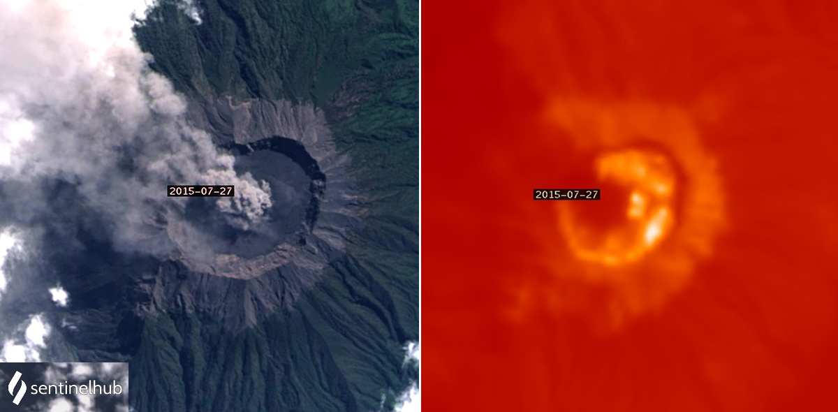
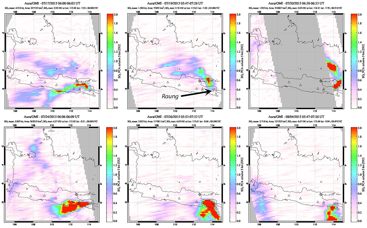
A satellite image on 20 July showed fresh incandescent lava covering the floor of the summit crater and a dense ash plume drifting N from the summit (figure 23). Incandescent ejecta emerged from two vents on the new pyroclastic cone inside the inner crater on 26 July (figure 24). On 27 July a dense ash plume was visible again in satellite imagery drifting NW and the hottest part of the thermal anomaly was in the SE quadrant of the crater (figure 25). Substantial SO2 plumes were recorded by the OMI instrument on the Aura satellite during July and early August 2015 (figure 26).
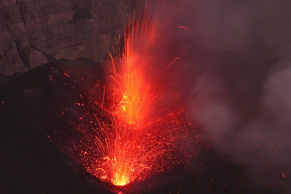
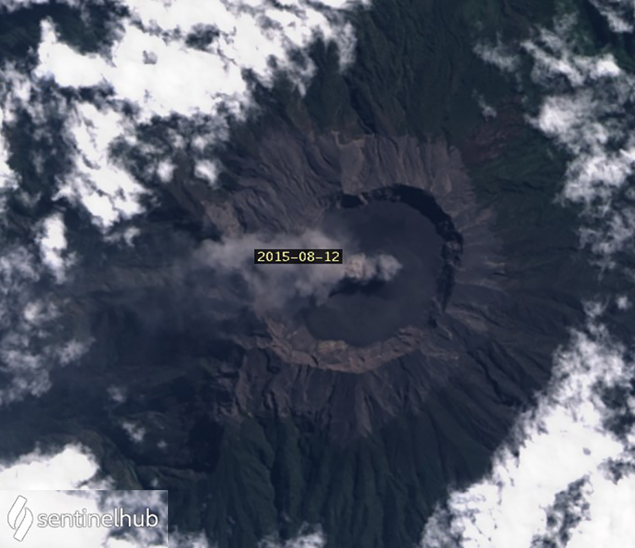
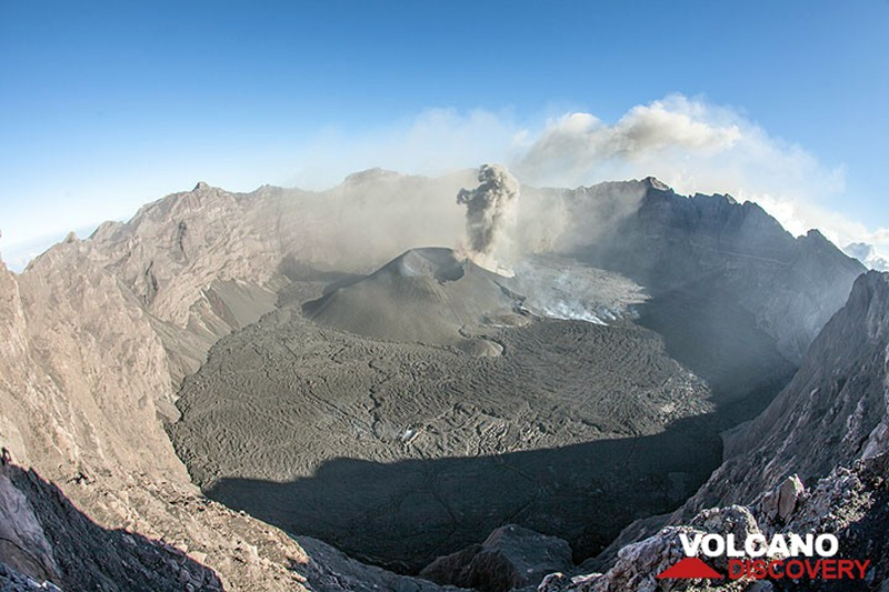
Significant ash emissions continued into early August 2015 with numerous flight cancellations. The Darwin VAAC reported ash plumes rising to 5.2 km altitude and extending as far as 750 km SE during the first two weeks in August (figure 27). Satellite imagery indicated a small ash plume drifting W from the center of the crater on 12 August and weak thermal anomalies along the E and S rim of the floor of the crater (figure 28). The summit crater was covered with fresh lava on 14 August when viewed by visitors, and ash emissions rose a few hundred meters above the crater rim from a vent in the SW side of the pyroclastic cone (figure 29). The visitors observed pulsating ash emissions rising from the SW vent on the large double-crater new cinder cone. The larger vent to the NE was almost entirely inactive except for two small, weakly effusive vents on its inner walls.
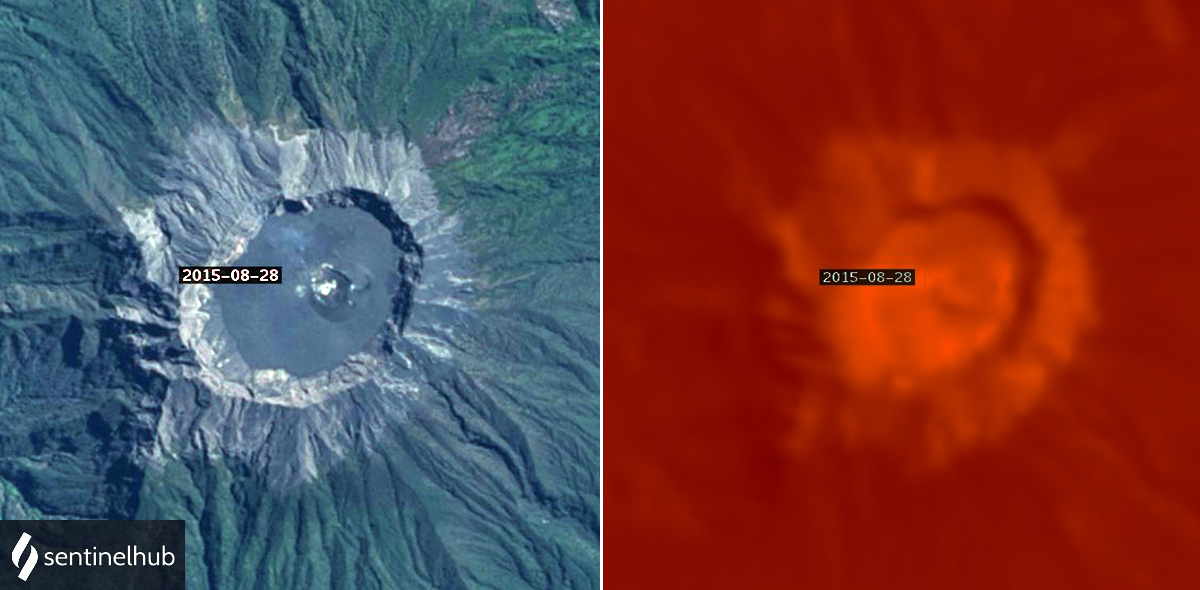
The lengthy sequence of multiple daily VAAC reports that began in late June ended on 16 August 2015 with reports becoming more intermittent and ash plume heights rising to only 3.7-3.9 km altitude. Multiple discontinuous eruptions to 3.9 km altitude were reported on 18 August. The plumes extended about 100 km NW. The last report of an ash plume was from an airline on 22 August noting a low-level plume 50 km NW. Two MODVOLC alerts were issued that day. By 28 August only a very small steam plume was present at the center of the crater; the southern half of the edge of the crater floor still had small thermal anomalies (figure 30). The last single MODVOLC thermal alerts were on 29 August and 7 September. The Alert Level was lowered to 2 on 24 August 2015, and further lowered to 1 on 20 October 2016.
Geological Summary. Raung, one of Java's most active volcanoes, is a massive stratovolcano in easternmost Java that was constructed SW of the rim of Ijen caldera. The unvegetated summit is truncated by a dramatic steep-walled, 2-km-wide caldera that has been the site of frequent historical eruptions. A prehistoric collapse of Gunung Gadung on the W flank produced a large debris avalanche that traveled 79 km, reaching nearly to the Indian Ocean. Raung contains several centers constructed along a NE-SW line, with Gunung Suket and Gunung Gadung stratovolcanoes being located to the NE and W, respectively.
Information Contacts: Pusat Vulkanologi dan Mitigasi Bencana Geologi (PVMBG, also known as Indonesian Center for Volcanology and Geological Hazard Mitigation, CVGHM), Jalan Diponegoro 57, Bandung 40122, Indonesia (URL: http://www.vsi.esdm.go.id/); Badan Nasional Penanggulangan Bencana (BNPB), National Disaster Management Agency, Graha BNPB - Jl. Scout Kav.38, East Jakarta 13120, Indonesia (URL: http://www.bnpb.go.id/); Hawai'i Institute of Geophysics and Planetology (HIGP) - MODVOLC Thermal Alerts System, School of Ocean and Earth Science and Technology (SOEST), Univ. of Hawai'i, 2525 Correa Road, Honolulu, HI 96822, USA (URL: http://modis.higp.hawaii.edu/); Darwin Volcanic Ash Advisory Centre (VAAC), Bureau of Meteorology, Northern Territory Regional Office, PO Box 40050, Casuarina, NT 0811, Australia (URL: http://www.bom.gov.au/info/vaac/);Google Earth (URL: https://www.google.com/earth/); Sentinel Hub Playground (URL: https://www.sentinel-hub.com/explore/sentinel-playground); NASA Earth Observatory, EOS Project Science Office, NASA Goddard Space Flight Center, Goddard, Maryland, USA (URL: http://earthobservatory.nasa.gov/, https://earthobservatory.nasa.gov/images/86213/eruption-of-raung-volcano); Tom Pfeiffer, Volcano Discovery (URL: http://www.volcanodiscovery.com/); Aris Yanto (URL: https://www.exploredesa.com/2012/11/mount-raung-produce-of-vulcanic-ash-plume-and-continue-eruption/); DigitalGlobe (URL: https://www.maxar.com/, https://twitter.com/Maxar/status/875449111398547457); Øystein Lund Andersen (URL: https://twitter.com/OysteinVolcano/status/1194879946042142726, http://www.oysteinlundandersen.com).