Report on Ambrym (Vanuatu) — May 2022
Bulletin of the Global Volcanism Network, vol. 47, no. 5 (May 2022)
Managing Editor: Edward Venzke.
Edited by Kadie L. Bennis.
Ambrym (Vanuatu) New ash eruption with crater incandescence in late January 2022
Please cite this report as:
Global Volcanism Program, 2022. Report on Ambrym (Vanuatu) (Bennis, K.L., and Venzke, E., eds.). Bulletin of the Global Volcanism Network, 47:5. Smithsonian Institution. https://doi.org/10.5479/si.GVP.BGVN202205-257040
Ambrym
Vanuatu
16.25°S, 168.12°E; summit elev. 1334 m
All times are local (unless otherwise noted)
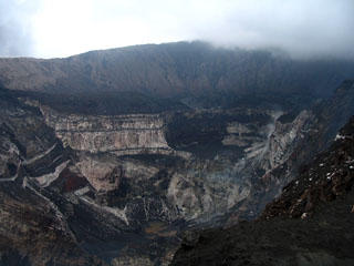
Ambrym contains a 12-km-wide caldera and is part of the New Hebrides Arc, located in the Vanuatu archipelago. The two currently active craters within the caldera are Benbow and Marum, which have produced lava lakes, explosions, lava flows, ash, and gas emissions. The previous eruption period, which began in May 2008, ended in December 2018 with lava fountains, lava flows, a submarine fissure eruption, and drainage of the lava lake (BGVN 45:03). After those events no eruptive activity was reported until January 2022, which consisted of ash plumes and crater incandescence. This report updates information from April 2020 through March 2022 and describes a short eruption period during 25 January to the beginning of February 2022. Information comes from the Vanuatu Meteorology and Geohazards Department (VMGD) and satellite data.
Activity during April 2020 through December 2021 was relatively low and consisted mainly of gas-and-steam emissions from both Benbow and Marum craters. On 25 January 2022 the Volcanic Alert Level (VAL) was raised from Level 1 to 2 (on a scale of 0-5) due to increased activity beginning around 0400. Significant gas-and-steam emissions were observed rising from Marum, and gas-and-ash emissions rose from Benbow at 0515 (figure 52). A sulfur dioxide plume that exceeded 2 DUs (Dobson Units) was detected on 25 January and drifted SE, following the ash plume, based on data from the Sentinel-5 instrument (figure 53). At night on 25 January, crater incandescence from Benbow was visible in webcam images, which represented a lava flow that had effused from a new vent on the NW part of the crater floor. Incandescence persisted through 27 January, according to VMGD (figure 54).
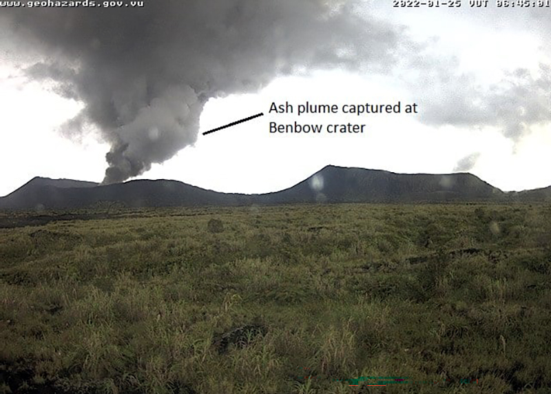 |
Figure 52. Webcam image of Ambrym at 0645 on 25 January 2022 showing an ash plume rising above the Benbow crater. Courtesy of VMGD. |
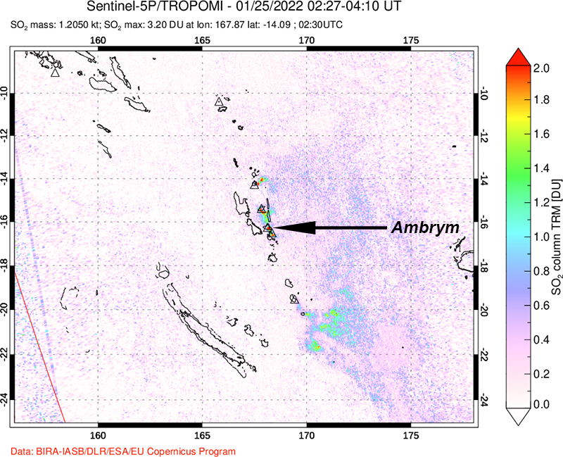 |
Figure 53. A sulfur dioxide plume was detected on 25 January 2022 based on Sentinel-5P data after increased activity, including an ash plume, occurred at Ambrym. The plume drifted SE. Courtesy of NASA Global Sulfur Dioxide Monitoring Page. |
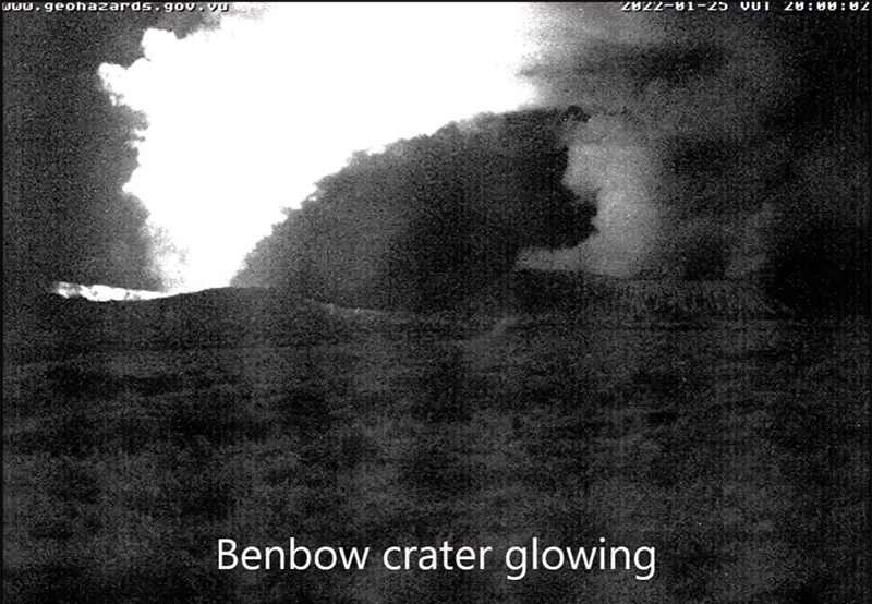 |
Figure 54. Webcam image showing visible nighttime incandescence coming from the Benbow crater at Ambrym at 2000 on 25 January 2022. Activity was visible through the early morning of 26 January, accompanied by gas-and-steam emissions. Courtesy of VMGD. |
By early February, crater incandescence was no longer visible. On 2 February sulfur dioxide emissions were still detected in satellite images and drifted E. According to VMGD, no gas-and-steam emissions were visible from Benbow during early February through April and seismicity had decreased. As a result, the VAL was lowered to Level 1 on 28 April.
Geological Summary. Ambrym, a large basaltic volcano with a 12-km-wide caldera, is one of the most active volcanoes of the New Hebrides Arc. A thick, almost exclusively pyroclastic sequence, initially dacitic then basaltic, overlies lava flows of a pre-caldera shield volcano. The caldera was formed during a major Plinian eruption with dacitic pyroclastic flows about 1,900 years ago. Post-caldera eruptions, primarily from Marum and Benbow cones, have partially filled the caldera floor and produced lava flows that ponded on the floor or overflowed through gaps in the caldera rim. Post-caldera eruptions have also formed a series of scoria cones and maars along a fissure system oriented ENE-WSW. Eruptions have apparently occurred almost yearly during historical time from cones within the caldera or from flank vents. However, from 1850 to 1950, reporting was mostly limited to extra-caldera eruptions that would have affected local populations.
Information Contacts: Geo-Hazards Division, Vanuatu Meteorology and Geo-Hazards Department (VMGD), Ministry of Climate Change Adaptation, Meteorology, Geo-Hazards, Energy, Environment and Disaster Management, Private Mail Bag 9054, Lini Highway, Port Vila, Vanuatu (URL: http://www.vmgd.gov.vu/, https://www.facebook.com/VanuatuGeohazardsObservatory/); NASA Global Sulfur Dioxide Monitoring Page, Atmospheric Chemistry and Dynamics Laboratory, NASA Goddard Space Flight Center (NASA/GSFC), 8800 Greenbelt Road, Goddard, MD 20771, USA (URL: https://so2.gsfc.nasa.gov/).