Report on Fonualei (Tonga) — December 1979
Scientific Event Alert Network Bulletin, vol. 4, no. 12 (December 1979)
Managing Editor: David Squires.
Fonualei (Tonga) Fumarolic activity noted during July
Please cite this report as:
Global Volcanism Program, 1979. Report on Fonualei (Tonga) (Squires, D., ed.). Scientific Event Alert Network Bulletin, 4:12. Smithsonian Institution. https://doi.org/10.5479/si.GVP.SEAN197912-243100
Fonualei
Tonga
18.023°S, 174.317°W; summit elev. 188 m
All times are local (unless otherwise noted)
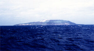
Most of the reported eruption sites were investigated during the 11-18 July cruise of the Fijian research vessel RV Bulikula.... Large fluctuations in the intensity of fumarolic activity were observed at both Fonualei and Tofua.
Geological Summary. The small island of Fonualei (~2 km diameter) contains a fumarolically active crater breached to the SE with a fresh lava flow extending to the sea and forming a rugged shoreline. Steep, inward-facing scarps mark the rim of a partially exposed caldera. Blocky lava flows fill much of the northern caldera moat and reach the sea to the north and east. In contrast to the andesitic and basaltic rocks of other islands of the Tonga arc, Fonualei lavas are of dominantly dacitic composition. Eruptions have been recorded since 1791, with the largest taking place in June 1846, when explosive eruptions produced large pumice rafts, ashfall damaged crops on the island of Vava'u (70 km SSE), and ash was reported by vessels up to 950 km distant. In 1939 explosive and effusive activity occurred from summit and flank vents, and water spouts were reported 1.6 km SE of the island.
Information Contacts: D. Woodhall and R. Richmond, Mineral Resources Dept., Fiji; D. Tuni, Ministry of Natural Resources, Solomon Islands.