Report on Mayon (Philippines) — July 1981
Scientific Event Alert Network Bulletin, vol. 6, no. 7 (July 1981)
Managing Editor: Lindsay McClelland.
Mayon (Philippines) Mudflow casualties updated
Please cite this report as:
Global Volcanism Program, 1981. Report on Mayon (Philippines) (McClelland, L., ed.). Scientific Event Alert Network Bulletin, 6:7. Smithsonian Institution. https://doi.org/10.5479/si.GVP.SEAN198107-273030
Mayon
Philippines
13.257°N, 123.685°E; summit elev. 2462 m
All times are local (unless otherwise noted)
Updated casualty figures indicate that the S- and E-flank mudflows triggered 30 June by typhoon Daling killed 40 persons, injured nine, and left seven missing. Other reported casualties were caused by the typhoon itself and associated flooding.
Further Reference. Gianan, O., 1982, A volcano disaster preparedness plan: mechanics of implementation of "Operation Mayon": Proceedings of the First Seminar Workshop on Philippine Volcanoes and Volcanic Terranes, Quezon City, Dec. 1982, p. 88-97.
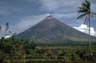
Geological Summary. Symmetrical Mayon, which rises above the Albay Gulf NW of Legazpi City, is the most active volcano of the Philippines. The steep upper slopes are capped by a small summit crater. Recorded eruptions since 1616 CE range from Strombolian to basaltic Plinian, with cyclical activity beginning with basaltic eruptions, followed by longer periods of andesitic lava flows. Eruptions occur predominately from the central conduit and have also produced lava flows that travel far down the flanks. Pyroclastic density currents and mudflows have commonly swept down many of the approximately 40 ravines that radiate from the summit and have often damaged populated lowland areas. A violent eruption in 1814 killed more than 1,200 people and devastated several towns.
Information Contacts: O. Peña, COMVOL, Quezon City.

