Report on Sorikmarapi (Indonesia) — July 1986
Scientific Event Alert Network Bulletin, vol. 11, no. 7 (July 1986)
Managing Editor: Lindsay McClelland.
Sorikmarapi (Indonesia) No new explosions
Please cite this report as:
Global Volcanism Program, 1986. Report on Sorikmarapi (Indonesia) (McClelland, L., ed.). Scientific Event Alert Network Bulletin, 11:7. Smithsonian Institution. https://doi.org/10.5479/si.GVP.SEAN198607-261120
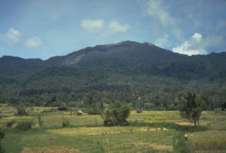
Sorikmarapi
Indonesia
0.686°N, 99.539°E; summit elev. 2145 m
All times are local (unless otherwise noted)
The ash plume from the 5 July explosion reached 700 m above the summit. No additional explosions have been recorded.
Geological Summary. Sorikmarapi is a forested stratovolcano with a 600-m-wide summit crater containing a lake and substantial sulfur deposits. A smaller upper SE flank crater (Danau Merah) also contains a crater lake; these two craters and a series of smaller explosion pits occur along a NW-SE line. Several solfatara fields are located on the E flank. Phreatic eruptions have occurred from summit and flank vents during the 19th and 20th centuries.
Information Contacts: L. Pardyanto, Olas, Kaswanda, Suratman, A. Sudradjat, and T. Casadevall, VSI.