Report on Bardarbunga (Iceland) — 18 February-24 February 2015
Smithsonian Institution / US Geological Survey
Weekly Volcanic Activity Report, 18 February-24 February 2015
Managing Editor: Sally Sennert.
Please cite this report as:
Global Volcanism Program, 2015. Report on Bardarbunga (Iceland) (Sennert, S, ed.). Weekly Volcanic Activity Report, 18 February-24 February 2015. Smithsonian Institution and US Geological Survey.
Bardarbunga
Iceland
64.633°N, 17.516°W; summit elev. 2000 m
All times are local (unless otherwise noted)
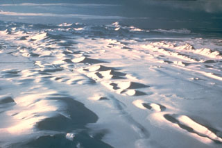
During 17-19 February, Icelandic Met Office reported continued activity at Bárdarbunga’s Holuhraun eruptive fissure, though the overall intensity of the eruption continued to decrease. Only one active vent was present in the crater, and the lava level in that crater continued to sink. The eruption plume rose no more than 1 km above the ground and drifted NE, and the lava channel was crusted over beyond the uppermost 200-300 m. The lava tube continued to feed the N and NE parts of Holuhraun, inflating the lava field. The reduced effusion rate was no longer able to sustain active breakouts in an area 17-18 km ENE from the vent. A 24 February report noted that the rate of subsidence was less than 2 cm per day and lava flows decreased substantially. Seismic activity continued to decrease although it was still considered to be strong.
Geological Summary. The large central volcano of Bárðarbunga lies beneath the NW part of the Vatnajökull icecap, NW of Grímsvötn volcano, and contains a subglacial 700-m-deep caldera. Related fissure systems include the Veidivötn and Trollagigar fissures, which extend about 100 km SW to near Torfajökull volcano and 50 km NE to near Askja volcano, respectively. Voluminous fissure eruptions, including one at Thjorsarhraun, which produced the largest known Holocene lava flow on Earth with a volume of more than 21 km3, have occurred throughout the Holocene into historical time from the Veidivötn fissure system. The last major eruption of Veidivötn, in 1477, also produced a large tephra deposit. The subglacial Loki-Fögrufjöll volcanic system to the SW is also part of the Bárðarbunga volcanic system and contains two subglacial ridges extending from the largely subglacial Hamarinn central volcano; the Loki ridge trends to the NE and the Fögrufjöll ridge to the SW. Jökulhlaups (glacier-outburst floods) from eruptions at Bárðarbunga potentially affect drainages in all directions.