Report on La Palma (Spain) — 29 September-5 October 2021
Smithsonian Institution / US Geological Survey
Weekly Volcanic Activity Report, 29 September-5 October 2021
Managing Editor: Sally Sennert.
Please cite this report as:
Global Volcanism Program, 2021. Report on La Palma (Spain) (Sennert, S, ed.). Weekly Volcanic Activity Report, 29 September-5 October 2021. Smithsonian Institution and US Geological Survey.
La Palma
Spain
28.57°N, 17.83°W; summit elev. 2426 m
All times are local (unless otherwise noted)
The eruption at La Palma continued during 29 September-5 October, characterized by Strombolian explosions, lava fountaining from multiple vents, lava flows, and daily ash emissions. Seismicity continued to be elevated with earthquakes located mainly 10-15 km deep (though some were 25-40 km deep) in the same area where the swarm first began on 11 September; dozens of events were felt by residents.
Within the first eight days of the eruption, 21-27 September, an estimated 50 million cubic meters of material had been erupted. Just before midnight on 28 September the lava reached the ocean, producing a steam-and-gas plume; within 45 minutes the lava created a 50-m-high delta. The sulfur dioxide flux was as high as 16,760 tons per day. On 29 September the PEVOLCA (Plan de Emergencias Volcánicas de Canarias) steering committee restated that the 2.5 km and maritime exclusion zones around the vents and ocean entry, respectively, remained in effect; residents were periodically allowed to collect belongings and care for animals and crops. The lava covered almost 4.8 square kilometers, burying or damaging 744 buildings. There were 185 evacuees in a local hotel. Ash plumes continued to rise from the active vents, and IGN noted a decrease in plume altitude to 3.5 km (11,500 ft) a.s.l. on 29 September and then a rise to 5 km (16,400 ft) a.s.l. the next day.
Lava continued flowing to the sea along the same path. The lava delta had grown three times in size by 30 September to an estimated 0.17 square kilometers; the furthest edge of the delta was 450 m from the coast, it had spread laterally 600-800 m, and was as thick as 24 m. PEVOLCA lifted access restrictions for residents of Tazacorte, San Borondón, Marina Alta, Marina Baja, and La Condesa (nearly 4,000 people); they had previously been warned to stay indoors to minimize coming into contact with potentially toxic gas plumes generated from the ocean entry. Restrictions for other residents living near the margins of the flows were also lifted.
Two vents opened about 600 m NW of the main cone on 1 October and within two days had formed small cones. Lava from the vents traveled W and joined the main flow field downslope. The lava delta had extended 540 m from the coastline. Ash plumes rose to 3-5 km a.s.l. and drifted S on 2 October, and sulfur dioxide emissions were 3,401 tons per day.
By 3 October an estimated 946 houses had been completely demolished and 128 had been partially damaged. The width of the flow field was a maximum of 1,250 m and lava tubes were identified in satellite images. The lava delta had developed four lobes being fed by multiple flows and had an estimated area of 0.32 square kilometers. In the afternoon the frequency and intensity of explosive activity increased and bombs were ejected as far as 800 m. Lava fountains rose hundreds of meters and ash plumes rose as high as 4.5 km (14,800 ft) a.s.l. The sulfur dioxide emission rate reached 16,000 tons per day. During 1900-1945 one of the new cones collapsed, which allowed the inner lava lake to spill out, sending flows downslope carrying blocks from the destroyed portion of the cone. Ash plumes rose as high as 4.5 km a.s.l. and explosions ejected bombs on 5 October according to a news report. Some explosions produced dense black plumes that billowed as they rose above the vent. The Alert Level remained at Red (the highest level on a four-color scale) for affected communities.
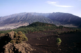
Geological Summary. The 47-km-long wedge-shaped island of La Palma, the NW-most of the Canary Islands, is composed of two large volcanic centers. The older northern one is cut by the steep-walled Caldera Taburiente, one of several massive collapse scarps produced by edifice failure to the SW. On the south, the younger Cumbre Vieja volcano is one of the most active in the Canaries. The elongated volcano dates back to about 125,000 years ago and is oriented N-S. Eruptions during the past 7,000 years have formed abundant cinder cones and craters along the axis, producing fissure-fed lava flows that descend steeply to the sea. Eruptions recorded since the 15th century have produced mild explosive activity and lava flows that damaged populated areas. The southern tip of the island is mantled by a broad lava field emplaced during the 1677-1678 eruption. Lava flows also reached the sea in 1585, 1646, 1712, 1949, 1971, and 2021.
Sources: Instituto Volcanológico de Canarias (INVOLCAN), Instituto Geográfico Nacional (IGN), EL PAÍS, EL PAÍS, EL PAÍS, EL PAÍS, EL PAÍS, Jorge Eduardo Romero Moyano (University of Manchester), Gobierno de Canaries, 1-1-2 Canarias