Report on Sorikmarapi (Indonesia) — 28 December-3 January 2012
Smithsonian Institution / US Geological Survey
Weekly Volcanic Activity Report, 28 December-3 January 2012
Managing Editor: Sally Sennert.
Please cite this report as:
Global Volcanism Program, 2011. Report on Sorikmarapi (Indonesia) (Sennert, S, ed.). Weekly Volcanic Activity Report, 28 December-3 January 2012. Smithsonian Institution and US Geological Survey.
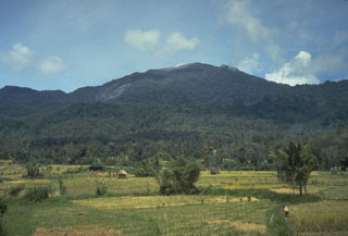
Sorikmarapi
Indonesia
0.686°N, 99.539°E; summit elev. 2145 m
All times are local (unless otherwise noted)
CVGHM lowered the Alert Level for Sorikmarapi on 30 December from 2 to 1 (on a scale of 1-4).
Geological Summary. Sorikmarapi is a forested stratovolcano with a 600-m-wide summit crater containing a lake and substantial sulfur deposits. A smaller upper SE flank crater (Danau Merah) also contains a crater lake; these two craters and a series of smaller explosion pits occur along a NW-SE line. Several solfatara fields are located on the E flank. Phreatic eruptions have occurred from summit and flank vents during the 19th and 20th centuries.
Source: Pusat Vulkanologi dan Mitigasi Bencana Geologi (PVMBG, also known as CVGHM)