Report on La Palma (Spain) — 20 October-26 October 2021
Smithsonian Institution / US Geological Survey
Weekly Volcanic Activity Report, 20 October-26 October 2021
Managing Editor: Sally Sennert.
Please cite this report as:
Global Volcanism Program, 2021. Report on La Palma (Spain) (Sennert, S, ed.). Weekly Volcanic Activity Report, 20 October-26 October 2021. Smithsonian Institution and US Geological Survey.
La Palma
Spain
28.57°N, 17.83°W; summit elev. 2426 m
All times are local (unless otherwise noted)
The eruption at La Palma continued during 20-26 October, characterized by Strombolian explosions, lava fountaining from multiple vents, advancing and branching lava flows, and daily ash emissions. Eruption details are based on official sources including PEVOLCA (Plan de Emergencias Volcánicas de Canarias) steering committee summaries issued daily. Seismicity remained elevated, with most earthquakes located 10-15 km deep (though some were as deep as 39 km); dozens of events were felt by local residents and some were felt across the entire island. A M 4.8 earthquake was recorded at 2248 on 19 October at a depth of 39 km, and the largest earthquake recorded since the beginning of the eruption, a M 4.9 at 38 km deep, was recorded at 1634 on 23 October; both of these events were felt across La Palma Island, as well as in some areas of Gomera and Tenerife islands.
The vents in the main cone continued to effuse lava, eject tephra, and produce sometimes dense and billowing ash-and-gas plumes that rose 2.8-4 km (9,200-13,100 ft) a.s.l. Sulfur dioxide emissions fluctuated at high levels between 3,200 and 53,600 tons per day. Four vents in the main cone were active, though the activity levels varied in intensity throughout the week. A new vent opened on 19 October, in an area between the 16 October vent (located 300 m from the SE base of the main cone) and the main cone. The new vent began with explosive phreatomagmatic activity before Strombolian activity commenced. The main cone changed shape, with cycles of partial crater rim and wall collapses and growth as the eruption continued. Explosions and a lava overflow from the main cone were visible at 2000 on 22 October. A partial collapse of the NW flank of the main cone on 23 October intensified ash emissions and sent large blocks downslope; the blocks fell onto another vent, causing lava to spill out into numerous lava flows. Strong explosions were heard at 1230 and lava overflowed a vent on the flanks of the main cone at 1415. On 24 October tall lava fountains rose from at least two vents. During the afternoon, a new vent opened on the W flank and effused lava at a high rate. The vent grew taller and widened during 24-25 October. The vent located at the SE end of the fissure produced slow-moving lava flows that traveled SW. Very intense explosive activity was visible on 25 October. A small collapse of the cone was observed at 1700. At around 2100 a lava lake in the main cone increased in volume, causing a partial collapse of the upper part of the cone, and producing large, detached blocks that were carried downslope by several lava flows. Lava fountains rose about 600 m above the vent.
The lava-flow field was characterized by three main areas: the initial main flow that traveled W, flowing around the S part of Montaña de Todoque, toward the sea and created a lava delta, a flow that had branched off of the main flow to the S, and the flows that traveled W along the N margins of the main flow. Lava flows sometimes overflowed their channels, forming ephemeral flows that spread laterally, descended short distances, and were also transported downslope in lava tubes. The lava flows along the northern margins (the N flow) were the most active; the flow that traveled N of Montaña Todoque had stopped, while the flow to the S of Montaña de La Laguna continued to advance and spread laterally. A lull in lava advancement during 22-23 October allowed for some homeowners to retrieve items from their residences. Lava advanced over some areas in the flow field that were previously unaffected, particularly in Alcalá, and covered an estimated 8.79 square kilometers by 26 October. The farthest end of N flows was less than 100 m from the coastline.
Lava at the delta had reached 120 m water depth and rock fragments from the end of the flow were observed at depths of 360 m. The thickness of the flow at the delta was 10-30 m; lava had filled the upper and middle parts of underwater ravines and covered an area of about 0.11 square kilometers. Scientists observed an absence of marine life around the lava flows.
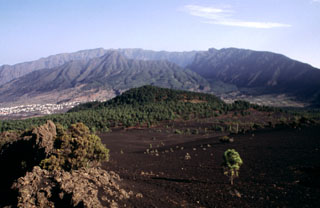
Geological Summary. The 47-km-long wedge-shaped island of La Palma, the NW-most of the Canary Islands, is composed of two large volcanic centers. The older northern one is cut by the steep-walled Caldera Taburiente, one of several massive collapse scarps produced by edifice failure to the SW. On the south, the younger Cumbre Vieja volcano is one of the most active in the Canaries. The elongated volcano dates back to about 125,000 years ago and is oriented N-S. Eruptions during the past 7,000 years have formed abundant cinder cones and craters along the axis, producing fissure-fed lava flows that descend steeply to the sea. Eruptions recorded since the 15th century have produced mild explosive activity and lava flows that damaged populated areas. The southern tip of the island is mantled by a broad lava field emplaced during the 1677-1678 eruption. Lava flows also reached the sea in 1585, 1646, 1712, 1949, 1971, and 2021.
Sources: Instituto Volcanológico de Canarias (INVOLCAN), Instituto Geográfico Nacional (IGN), Gobierno de Canaries