Keyword Collections | Keyword "umbrella cloud"
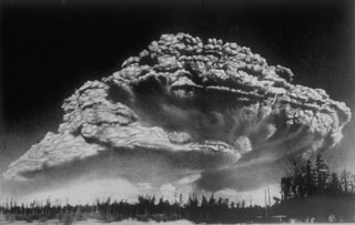 Following a period of explosive eruptions and lava-dome growth beginning in October 1955, a major explosive eruption took place on 30 March 1956 at Bezymianny volcano in Kamchatka. The Plinian eruption, seen here from 100 km W, produced a 40-km-high ash column, pyroclastic flow to a distance of 18 km, lateral blast, and a debris avalanche when the summit of the volcano collapsed.
Photo by I. V. Yerov, 1956 (courtesy of G.S. Gorshkov, published in Green and Short, 1971).
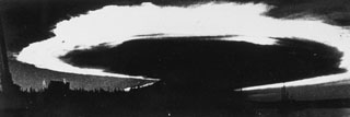 Caldera collapse in 1968 at the basaltic shield volcano, Fernandina, was preceded by lava effusion on the SE flank and a major explosive eruption on 11 June. The ash plume, seen here from Academy Bay on Santa Cruz Island within minutes of the explosion, is backlit by the late afternoon sun and was spreading at an estimated lateral speed of 80 km per hour. At the time of this photograph the ash plume was 175 km across with an altitude of 20-25 km.
Photo by J. Harte, 1968 (published in Simkin and Howard, 1970).
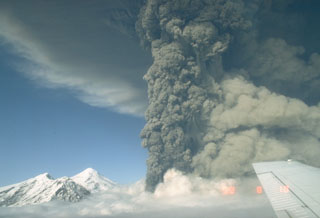 This photo shows an ash plume during the eruption of Spurr on 18 August 1992. A lighter plume rises above pyroclastic flows descending the SE flank to the right, and the summit lava dome complex is to the left. The 18 August event was the second of three brief powerful explosive eruptions in 1992.
Photo by Game McGimsey, 1992 (Alaska Volcano Observatory, U.S. Geological Survey).
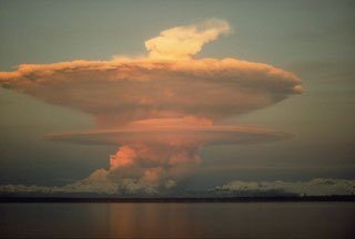 An ash plume from the pyroclastic flow descending the N flank of Redoubt volcano on 21 April 1990. The ash plumes produced during the 1989-1990 eruption damaged five commercial jet liners, with an incident on 15 December 1989 causing a Boeing 747-400 aircraft to temporarily lose power of all four engines.
Photo by Joyce Warren, 1990 (courtesy of U.S. Geological Survey).
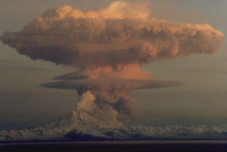 A series of powerful eruptions at Redoubt began on 14 December 1989. This 18 December view from the Kenai Peninsula across Cook Inlet shows an umbrella cloud that appears to originate from a vent on the N flank, but is actually ash from a pyroclastic flow that is traveling down the Drift River valley to the north. Ash plumes during the initial days of the eruption reached heights of about 10 km. Several episodes of strong explosive activity and lava dome growth lasted until June.
Copyrighted photo by Robert Clucas, 1990.


