Image GVP-00276
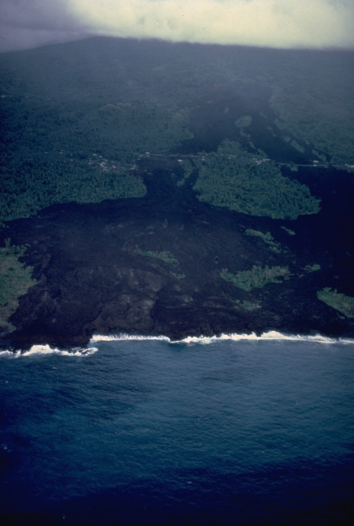
An eruption from a SW-flank fissure beginning April 5, 1977 produced a lava flow that reached the sea and destroyed or damaged villages located along the E-W-trending road cutting across the center of the photo. The 5-day-long eruption originated from a cinder cone constructed along a vent at 360-m altitude. The basaltic lava flow traveled about 2 km and reached the sea along a 1.5-km-long front. About 300 houses were destroyed in the villages of Singani (left) and Hesa (right). The flow diverged around a vegetated kipuka, sparing houses there.
Copyrighted photo by Katia and Maurice Krafft, 1980.
Copyrighted image used with permission. All Rights Reserved. Contact photographer for any usage requests.

Karthala