Image GVP-00459
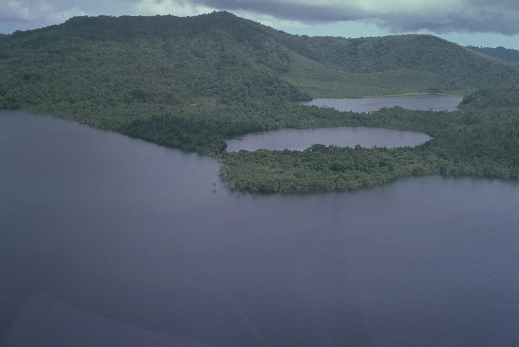
Shown here is the 10.5 x 13.5 km Dakataua caldera at the N tip of the Willaumez Peninsula. Caldera-formatting activity occurred as recently as about 1,150 years ago. A 12-km-wide freshwater lake (foreground), whose surface is only about 50 m above sea level, occupies the caldera. This view from the W shows two maars (right center) and Mount Makalia (top left), which are located along a N-S-trending peninsula.
Photo by Russell Blong, 1988 (Macquarie University).
![]() This image is made available under the Creative Commons BY-NC 4.0 license terms.
This image is made available under the Creative Commons BY-NC 4.0 license terms.
Galleries: Maars

Dakataua