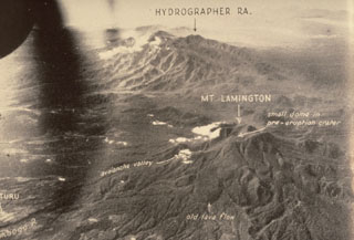
Global Volcanism Program | Image GVP-00484
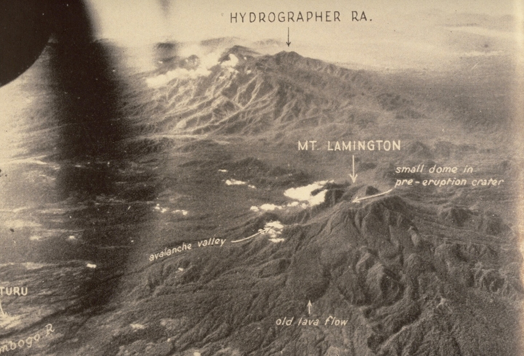
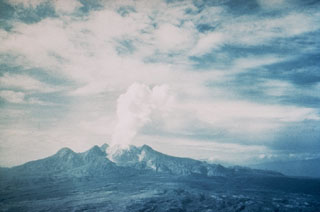
The Hydrographers Range, seen here from the W, is a forested, deeply dissected volcanic massif extending from the E margin of Mount Lamington (lower right) to the northern coast of Papua New Guinea. Most activity took place during the Pleistocene, but well-preserved scoria cones and craters suggest that some Holocene activity occurred. This 1947 photo was taken prior to Lamington's catastrophic eruption in 1951.
Photo by Royal Australian Air Force, 1947 (published in Taylor, 1958).
![]() This image is made available under the Creative Commons BY-NC-ND 4.0 license terms.
This image is made available under the Creative Commons BY-NC-ND 4.0 license terms.
Keywords: lava flow | erosion | stratovolcano | crater
Hydrographers Range
Lamington