Image GVP-01900
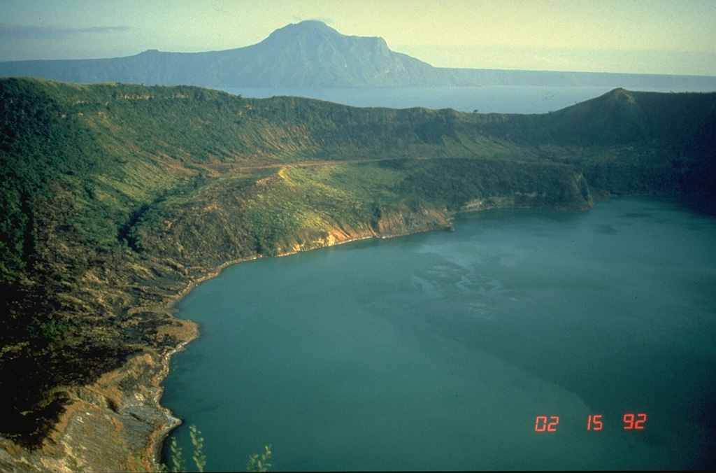
This view of Main Crater Lake in the 3-km-wide caldera on Volcano Island, looks across Lake Taal to the NE rim of the 15 x 20 km Taal caldera. The surface of the 267 km2 lake is only 3 m above sea level. Volcano Island has been the source of explosive eruptions with pyroclastic surges that devastated lakeshore areas. Pleistocene eruptions that formed the caldera greatly modified the topography of southern Luzon Island.
Photo by Chris Newhall, 1989 (U.S. Geological Survey).
![]() This image is made available as a Public Domain Work, but proper attribution is appreciated.
This image is made available as a Public Domain Work, but proper attribution is appreciated.

Taal