Image GVP-02679
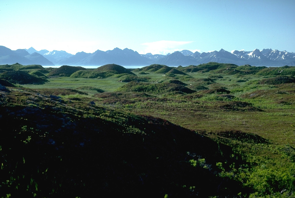
This hummocky terrain is the surface of the debris avalanche deposit from summit collapse at Augustine about 250-450 years ago, which forms the entire 2 x 3 km wide West Island. There are more than 1,000 hummocks with heights up to 30 m across the island. Bathymetric surveys suggest that the avalanche traveled an additional 3 km beyond the margin of West Island. Kamishak Bay and the Chigmit Mountains are on the horizon to the NW.
Photo by Lee Siebert, 1986 (Smithsonian Institution).
![]() This image is made available under the Public Domain Dedication CC0 license, but proper attribution is appreciated.
This image is made available under the Public Domain Dedication CC0 license, but proper attribution is appreciated.
Galleries: Debris Avalanches / Landslides
Keywords: hummock | deposit | debris avalanche deposit
Augustine